San Pedro Sochiápam geodata
San Pedro Sochiápam (Oaxaca) is a seat of a second-order administrative division; located in Mexico in America/Mexico_City (GMT-6) time zone. With population of 1,843 people, there are 4715 cities with bigger population in this country. Compared to other cities in Mexico, 80.3% of cities are located further ↑North; 78.8% of cities are located further ←West and 53.8% of cities have higher elevation than San Pedro Sochiápam. Note1


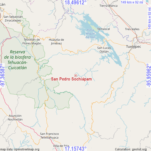
San Pedro Sochiápam GPS coordinates[2]
17° 49' 40.908" North, 96° 39' 45.864" West
| Map corner | latitude | longitude |
|---|---|---|
| Upper-left | 18.49612°, | -97.36587° |
| Center: | 17.82803°, | -96.66274° |
| Lower-right: | 17.15743°, | -95.95962° |
| Map W x H: | 148.8×148.9 km | = 92.5×92.5mi |
| max Lat: | 32.7° ⇑80.3% North |
| San Pedro Sochiápam: | 17.82803° |
| min Lat: | ⇓19.7% South 14.53588° |
| min Long | San Pedro Sochi | max Long |
| -117.105° | -96.66274° | -86.73105° |
| W 78.8%⇐ | ⇒21.2% E |
Elevation
Elevation of San Pedro Sochiápam is 1252 m = 4108 ft, and this is 1.7 m = 6 ft below average elevation for this country.
| Max E: |
3497 m = 11473 ft | 53.8% |
| Avg. | 1253.7 m = 4113 ft | |
| San Pedro Sochiápam | 1252 m = 4108 ft | |
Min E: |
-1 m = -3 ft | 46.2% |
See also: Mexico elevation on elevation.city.
Geographical zone
San Pedro Sochiápam is located in North Torrid zone (between Equator and Tropic of Cancer). Distance of this Northern Tropic circle is 623.6 km =387.5 mi to North.| Distance of | km | miles | from San Pedro Sochiápam |
|---|---|---|---|
| North Pole | 8024.8 | 4986.4 | to North |
| Arctic Circle | 5418.9 | 3367.1 | to North |
| Tropic Cancer | 623.6 | 387.5 | to North |
| Equator | 1982.3 | 1231.7 | to South |


Nearby cities:
15 places around San Pedro Sochiápam: (largest is in red/bold)
• Colonia Ampliación Aeropuerto
17.2 km =10.7 mi,  64°
64°
• San Alejo el Progreso
9.2 km =5.7 mi,  315°
315°
• San Andrés Teotilalpam
14 km =8.7 mi,  2°
2°
• San Felipe Usila
16.1 km =10 mi,  65°
65°
• San Juan Sautla
3.6 km =2.2 mi,  339°
339°
• San Juan Teponaxtla
13.7 km =8.5 mi,  206°
206°
• San Juan Zapotitlán
6.5 km =4 mi,  112°
112°
• San Miguel Santa Flor
17.8 km =11.1 mi,  305°
305°
• San Pedro Coyaltepec
14.9 km =9.3 mi,  244°
244°
• San Pedro Teutila
17.3 km =10.7 mi, 344°
• Santa María Pápalo
15 km =9.3 mi,  251°
251°
• Santa María Tlalixtac
15.6 km =9.7 mi,  329°
329°
• Santiago Quetzalapa
3.4 km =2.1 mi, 74°
• Santiago Tlatepusco
16.1 km =10 mi,  91°
91°
• Tlacoatzintepec
8.8 km =5.5 mi, 66°
Sources, notices
• [Note1] Compared only with cities in Mexico existing in our database
• [Src1] Map data: © OpenStreetMap contributors (CC-BY-SA)
• [Src2] Other city data from geonames.org with taken over terms of usage.
• [Src3] Geographical zone / Annual Mean Temperature by Robert A. Rohde @ Wikipedia
