San Pedro Chicozapotes geodata
San Pedro Chicozapotes (Oaxaca) is a populated place; located in Mexico in America/Mexico_City (GMT-6) time zone. With population of 884 people, there are 9870 cities with bigger population in this country. Compared to other cities in Mexico, 80.8% of cities are located further ↑North; 75.5% of cities are located further ←West and 66.4% of cities have higher elevation than San Pedro Chicozapotes. Note1


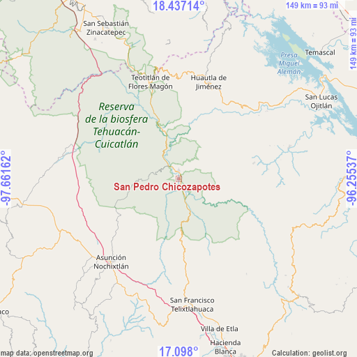
San Pedro Chicozapotes GPS coordinates[2]
17° 46' 7.752" North, 96° 57' 30.564" West
| Map corner | latitude | longitude |
|---|---|---|
| Upper-left | 18.43714°, | -97.66162° |
| Center: | 17.76882°, | -96.95849° |
| Lower-right: | 17.098°, | -96.25537° |
| Map W x H: | 148.9×148.9 km | = 92.5×92.5mi |
| max Lat: | 32.7° ⇑80.8% North |
| San Pedro Chicozapotes: | 17.76882° |
| min Lat: | ⇓19.2% South 14.53588° |
| min Long | San Pedro Chico | max Long |
| -117.105° | -96.95849° | -86.73105° |
| W 75.5%⇐ | ⇒24.5% E |
Elevation
Elevation of San Pedro Chicozapotes is 619 m = 2031 ft, and this is 634.7 m = 2082 ft below average elevation for this country.
| Max E: |
3497 m = 11473 ft | 66.4% |
| Avg. | 1253.7 m = 4113 ft | |
| San Pedro Chicozapotes | 619 m = 2031 ft | |
Min E: |
-1 m = -3 ft | 33.6% |
See also: Mexico elevation on elevation.city.
Geographical zone
San Pedro Chicozapotes is located in North Torrid zone (between Equator and Tropic of Cancer). Distance of this Northern Tropic circle is 630.2 km =391.6 mi to North.| Distance of | km | miles | from San Pedro Chicozapotes |
|---|---|---|---|
| North Pole | 8031.4 | 4990.5 | to North |
| Arctic Circle | 5425.5 | 3371.2 | to North |
| Tropic Cancer | 630.2 | 391.6 | to North |
| Equator | 1975.7 | 1227.6 | to South |


Nearby cities:
15 places around San Pedro Chicozapotes: (largest is in red/bold)
• Concepción Pápalo
11.5 km =7.1 mi,  44°
44°
• Cuicatlan
3.8 km =2.4 mi,  358°
358°
• Jaltepetongo
12.3 km =7.6 mi,  221°
221°
• San Francisco Tutepetongo
10.1 km =6.3 mi,  125°
125°
• San José del Chilar
6.8 km =4.2 mi,  160°
160°
• San Juan Coyula
17 km =10.6 mi,  17°
17°
• San Lorenzo Pápalo
15.3 km =9.5 mi,  32°
32°
• San Miguel Huautla
19.1 km =11.9 mi,  262°
262°
• San Pedro Coyaltepec
17.8 km =11.1 mi,  89°
89°
• San Pedro Jocotipac
12.8 km =8 mi,  269°
269°
• Santa María Pápalo
17.2 km =10.7 mi,  84°
84°
• Santos Reyes Pápalo
11 km =6.8 mi,  68°
68°
• Texcatitlán
13 km =8.1 mi,  241°
241°
• Tomellín
1.1 km =0.7 mi,  192°
192°
• Valerio Trujano
2.3 km =1.4 mi,  280°
280°
Sources, notices
• [Note1] Compared only with cities in Mexico existing in our database
• [Src1] Map data: © OpenStreetMap contributors (CC-BY-SA)
• [Src2] Other city data from geonames.org with taken over terms of usage.
• [Src3] Geographical zone / Annual Mean Temperature by Robert A. Rohde @ Wikipedia
