Benito Juárez geodata
Benito Juárez (Oaxaca) is a populated place; located in Mexico in America/Mexico_City (GMT-6) time zone. With population of 568 people, there are 15043 cities with bigger population in this country. Compared to other cities in Mexico, 83.7% of cities are located further ↑North; 84% of cities are located further ←West and 83% of cities have higher elevation than Benito Juárez. Note1


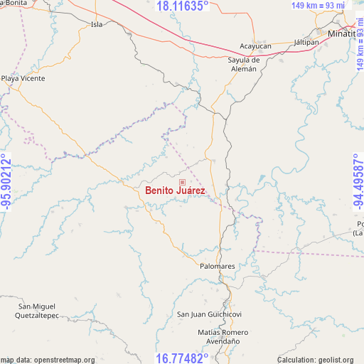
Benito Juárez GPS coordinates[2]
17° 26' 48.552" North, 95° 11' 56.364" West
| Map corner | latitude | longitude |
|---|---|---|
| Upper-left | 18.11635°, | -95.90212° |
| Center: | 17.44682°, | -95.19899° |
| Lower-right: | 16.77482°, | -94.49587° |
| Map W x H: | 149.2×149.2 km | = 92.7×92.7mi |
| max Lat: | 32.7° ⇑83.7% North |
| Benito Juárez: | 17.44682° |
| min Lat: | ⇓16.3% South 14.53588° |
| min Long | Benito Juárez | max Long |
| -117.105° | -95.19899° | -86.73105° |
| W 84%⇐ | ⇒16% E |
Elevation
Elevation of Benito Juárez is 60 m = 197 ft, and this is 1193.7 m = 3916 ft below average elevation for this country.
| Max E: |
3497 m = 11473 ft | 83% |
| Avg. | 1253.7 m = 4113 ft | |
| Benito Juárez | 60 m = 197 ft | |
Min E: |
-1 m = -3 ft | 17% |
See also: Mexico elevation on elevation.city.
Geographical zone
Benito Juárez is located in North Torrid zone (between Equator and Tropic of Cancer). Distance of this Northern Tropic circle is 666 km =413.8 mi to North.| Distance of | km | miles | from Benito Juárez |
|---|---|---|---|
| North Pole | 8067.2 | 5012.7 | to North |
| Arctic Circle | 5461.3 | 3393.5 | to North |
| Tropic Cancer | 666 | 413.8 | to North |
| Equator | 1939.9 | 1205.4 | to South |


Nearby cities:
15 places around Benito Juárez: (largest is in red/bold)
• Arroyo Peña Amarilla
12.1 km =7.5 mi,  327°
327°
• Coapiloloyita
21 km =13 mi,  96°
96°
• Constitución Mexicana
21.9 km =13.6 mi,  237°
237°
• El Paraíso
9.7 km =6 mi,  37°
37°
• El Porvenir
6.8 km =4.2 mi,  296°
296°
• El Súchil
19.7 km =12.2 mi,  68°
68°
• Emiliano Zapata
4.3 km =2.7 mi,  345°
345°
• Jesús Carranza
18.4 km =11.4 mi,  94°
94°
• La Nueva Raza
3.8 km =2.4 mi,  82°
82°
• Loma Bonita
21.9 km =13.6 mi,  34°
34°
• Los Ángeles
6.8 km =4.2 mi,  148°
148°
• Nuevo Cerro Mojarra
13.8 km =8.6 mi,  269°
269°
• Palo Dulce
12.7 km =7.9 mi, 95°
• San Felipe Cihualtepec
18.2 km =11.3 mi,  280°
280°
• Suchilapan del Río
23.4 km =14.5 mi,  106°
106°
Sources, notices
• [Note1] Compared only with cities in Mexico existing in our database
• [Src1] Map data: © OpenStreetMap contributors (CC-BY-SA)
• [Src2] Other city data from geonames.org with taken over terms of usage.
• [Src3] Geographical zone / Annual Mean Temperature by Robert A. Rohde @ Wikipedia
