Los Ángeles geodata
Los Ángeles (Oaxaca) is a populated place; located in Mexico in America/Mexico_City (GMT-6) time zone. With population of 1,144 people, there are 7588 cities with bigger population in this country. Compared to other cities in Mexico, 84.2% of cities are located further ↑North; 84.1% of cities are located further ←West and 84.7% of cities have higher elevation than Los Ángeles. Note1


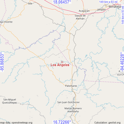
Los Ángeles GPS coordinates[2]
17° 23' 41.46" North, 95° 9' 55.44" West
| Map corner | latitude | longitude |
|---|---|---|
| Upper-left | 18.06457°, | -95.86853° |
| Center: | 17.39485°, | -95.1654° |
| Lower-right: | 16.72266°, | -94.46228° |
| Map W x H: | 149.2×149.2 km | = 92.7×92.7mi |
| max Lat: | 32.7° ⇑84.2% North |
| Los Ángeles: | 17.39485° |
| min Lat: | ⇓15.8% South 14.53588° |
| min Long | Los Ángeles | max Long |
| -117.105° | -95.1654° | -86.73105° |
| W 84.1%⇐ | ⇒15.9% E |
Elevation
Elevation of Los Ángeles is 46 m = 151 ft, and this is 1207.7 m = 3962 ft below average elevation for this country.
| Max E: |
3497 m = 11473 ft | 84.7% |
| Avg. | 1253.7 m = 4113 ft | |
| Los Ángeles | 46 m = 151 ft | |
Min E: |
-1 m = -3 ft | 15.3% |
See also: Mexico elevation on elevation.city.
Geographical zone
Los Ángeles is located in North Torrid zone (between Equator and Tropic of Cancer). Distance of this Northern Tropic circle is 671.8 km =417.4 mi to North.| Distance of | km | miles | from Los Ángeles |
|---|---|---|---|
| North Pole | 8072.9 | 5016.3 | to North |
| Arctic Circle | 5467 | 3397 | to North |
| Tropic Cancer | 671.8 | 417.4 | to North |
| Equator | 1934.1 | 1201.8 | to South |


Nearby cities:
15 places around Los Ángeles: (largest is in red/bold)
• Arroyo Peña Amarilla
18.9 km =11.7 mi,  328°
328°
• Benito Juárez
6.8 km =4.2 mi, 328°
• Coapiloloyita
17.6 km =10.9 mi,  79°
79°
• Donaji
21.9 km =13.6 mi,  147°
147°
• El Paraíso
13.7 km =8.5 mi,  10°
10°
• El Porvenir
13.1 km =8.1 mi,  312°
312°
• El Súchil
19.6 km =12.2 mi,  48°
48°
• Emiliano Zapata
10.9 km =6.8 mi, 334°
• Jesús Carranza
15.4 km =9.6 mi,  73°
73°
• La Mixtequita
22.1 km =13.7 mi,  192°
192°
• La Nueva Raza
6.2 km =3.9 mi,  1°
1°
• Nuevo Cerro Mojarra
18.3 km =11.4 mi,  288°
288°
• Palo Dulce
10.2 km =6.3 mi,  63°
63°
• Plan de San Luis
22.1 km =13.7 mi,  118°
118°
• Suchilapan del Río
18.8 km =11.7 mi,  92°
92°
Sources, notices
• [Note1] Compared only with cities in Mexico existing in our database
• [Src1] Map data: © OpenStreetMap contributors (CC-BY-SA)
• [Src2] Other city data from geonames.org with taken over terms of usage.
• [Src3] Geographical zone / Annual Mean Temperature by Robert A. Rohde @ Wikipedia
