Suchilapan del Río geodata
Suchilapan del Río (Veracruz) is a populated place; located in Mexico in America/Mexico_City (GMT-6) time zone. With population of 2,487 people, there are 3552 cities with bigger population in this country. Compared to other cities in Mexico, 84.3% of cities are located further ↑North; 84.7% of cities are located further ←West and 85.3% of cities have higher elevation than Suchilapan del Río. Note1


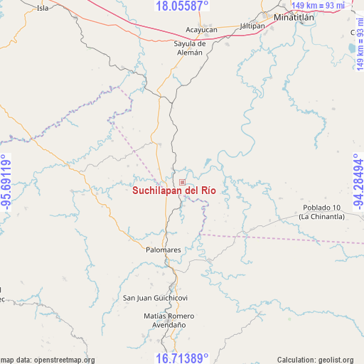
Suchilapan del Río GPS coordinates[2]
17° 23' 9.996" North, 94° 59' 17.016" West
| Map corner | latitude | longitude |
|---|---|---|
| Upper-left | 18.05587°, | -95.69119° |
| Center: | 17.38611°, | -94.98806° |
| Lower-right: | 16.71389°, | -94.28494° |
| Map W x H: | 149.2×149.2 km | = 92.7×92.7mi |
| max Lat: | 32.7° ⇑84.3% North |
| Suchilapan del Río: | 17.38611° |
| min Lat: | ⇓15.7% South 14.53588° |
| min Long | Suchilapan del | max Long |
| -117.105° | -94.98806° | -86.73105° |
| W 84.7%⇐ | ⇒15.3% E |
Elevation
Elevation of Suchilapan del Río is 42 m = 138 ft, and this is 1211.7 m = 3975 ft below average elevation for this country.
| Max E: |
3497 m = 11473 ft | 85.3% |
| Avg. | 1253.7 m = 4113 ft | |
| Suchilapan del Río | 42 m = 138 ft | |
Min E: |
-1 m = -3 ft | 14.7% |
See also: Mexico elevation on elevation.city.
Geographical zone
Suchilapan del Río is located in North Torrid zone (between Equator and Tropic of Cancer). Distance of this Northern Tropic circle is 672.8 km =418.1 mi to North.| Distance of | km | miles | from Suchilapan del Río |
|---|---|---|---|
| North Pole | 8073.9 | 5016.9 | to North |
| Arctic Circle | 5468 | 3397.7 | to North |
| Tropic Cancer | 672.8 | 418.1 | to North |
| Equator | 1933.2 | 1201.2 | to South |


Nearby cities:
15 places around Suchilapan del Río: (largest is in red/bold)
• Benito Juárez
23.4 km =14.5 mi,  286°
286°
• Coapiloloyita
4.5 km =2.8 mi,  340°
340°
• Donaji
18.7 km =11.6 mi,  201°
201°
• El Paraíso
21.8 km =13.5 mi,  311°
311°
• El Súchil
14.6 km =9.1 mi, 343°
• El Tepache
21.9 km =13.6 mi,  54°
54°
• Emiliano Zapata
25.8 km =16 mi, 294°
• Jesús Carranza
6.8 km =4.2 mi,  323°
323°
• La Nueva Raza
20 km =12.4 mi, 291°
• Los Ángeles
18.8 km =11.7 mi,  272°
272°
• Modelo Dos Ríos
23.7 km =14.7 mi,  87°
87°
• Palo Dulce
11.2 km =7 mi,  299°
299°
• Plan de San Luis
9.6 km =6 mi,  176°
176°
• Tolosita
21.6 km =13.4 mi, 198°
• Veinticuatro
23.9 km =14.9 mi,  132°
132°
Sources, notices
• [Note1] Compared only with cities in Mexico existing in our database
• [Src1] Map data: © OpenStreetMap contributors (CC-BY-SA)
• [Src2] Other city data from geonames.org with taken over terms of usage.
• [Src3] Geographical zone / Annual Mean Temperature by Robert A. Rohde @ Wikipedia
