Monte Águila geodata
Monte Águila (Oaxaca) is a populated place; located in Mexico in America/Mexico_City (GMT-6) time zone. With population of 669 people, there are 12968 cities with bigger population in this country. Compared to other cities in Mexico, 87.3% of cities are located further ↑North; 83.8% of cities are located further ←West and 76.2% of cities have higher elevation than Monte Águila. Note1


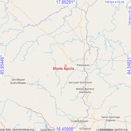
Monte Águila GPS coordinates[2]
17° 7' 55.956" North, 95° 15' 4.788" West
| Map corner | latitude | longitude |
|---|---|---|
| Upper-left | 17.80291°, | -95.95446° |
| Center: | 17.13221°, | -95.25133° |
| Lower-right: | 16.45908°, | -94.54821° |
| Map W x H: | 149.4×149.4 km | = 92.8×92.8mi |
| max Lat: | 32.7° ⇑87.3% North |
| Monte Águila: | 17.13221° |
| min Lat: | ⇓12.7% South 14.53588° |
| min Long | Monte Águila | max Long |
| -117.105° | -95.25133° | -86.73105° |
| W 83.8%⇐ | ⇒16.2% E |
Elevation
Elevation of Monte Águila is 181 m = 594 ft, and this is 1072.7 m = 3519 ft below average elevation for this country.
| Max E: |
3497 m = 11473 ft | 76.2% |
| Avg. | 1253.7 m = 4113 ft | |
| Monte Águila | 181 m = 594 ft | |
Min E: |
-1 m = -3 ft | 23.8% |
See also: Mexico elevation on elevation.city.
Geographical zone
Monte Águila is located in North Torrid zone (between Equator and Tropic of Cancer). Distance of this Northern Tropic circle is 701 km =435.6 mi to North.| Distance of | km | miles | from Monte Águila |
|---|---|---|---|
| North Pole | 8102.1 | 5034.4 | to North |
| Arctic Circle | 5496.3 | 3415.2 | to North |
| Tropic Cancer | 701 | 435.6 | to North |
| Equator | 1904.9 | 1183.6 | to South |


Nearby cities:
15 places around Monte Águila: (largest is in red/bold)
• Donaji
23.7 km =14.7 mi,  62°
62°
• Encinal Colorado
20.5 km =12.7 mi,  131°
131°
• La Mixtequita
8.7 km =5.4 mi,  28°
28°
• Loma Santa Cruz
17.7 km =11 mi,  206°
206°
• Los Fresnos
15 km =9.3 mi,  320°
320°
• Nuevo Progreso
21.4 km =13.3 mi,  88°
88°
• Palomares
20.1 km =12.5 mi, 88°
• Paso Real de Sarabia
22.7 km =14.1 mi,  106°
106°
• San Juan Mazatlán
23.6 km =14.7 mi,  241°
241°
• San Pedro Evangelista
5.7 km =3.5 mi,  349°
349°
• Santa Ana
19.7 km =12.2 mi,  116°
116°
• Santiago Tutla
14.7 km =9.1 mi,  297°
297°
• Tierra Negra
22.3 km =13.9 mi, 295°
• Tolosita
22.6 km =14 mi,  70°
70°
• Zacatal
22 km =13.7 mi,  166°
166°
Sources, notices
• [Note1] Compared only with cities in Mexico existing in our database
• [Src1] Map data: © OpenStreetMap contributors (CC-BY-SA)
• [Src2] Other city data from geonames.org with taken over terms of usage.
• [Src3] Geographical zone / Annual Mean Temperature by Robert A. Rohde @ Wikipedia
