Palomares geodata
Palomares (Oaxaca) is a populated place; located in Mexico in America/Mexico_City (GMT-6) time zone. With population of 3,760 people, there are 2440 cities with bigger population in this country. Compared to other cities in Mexico, 87.3% of cities are located further ↑North; 84.4% of cities are located further ←West and 78.6% of cities have higher elevation than Palomares. Note1


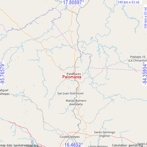
Palomares GPS coordinates[2]
17° 8' 17.88" North, 95° 3' 45.576" West
| Map corner | latitude | longitude |
|---|---|---|
| Upper-left | 17.80897°, | -95.76579° |
| Center: | 17.1383°, | -95.06266° |
| Lower-right: | 16.4652°, | -94.35954° |
| Map W x H: | 149.4×149.4 km | = 92.8×92.8mi |
| max Lat: | 32.7° ⇑87.3% North |
| Palomares: | 17.1383° |
| min Lat: | ⇓12.7% South 14.53588° |
| min Long | Palomares | max Long |
| -117.105° | -95.06266° | -86.73105° |
| W 84.4%⇐ | ⇒15.6% E |
Elevation
Elevation of Palomares is 118 m = 387 ft, and this is 1135.7 m = 3726 ft below average elevation for this country.
| Max E: |
3497 m = 11473 ft | 78.6% |
| Avg. | 1253.7 m = 4113 ft | |
| Palomares | 118 m = 387 ft | |
Min E: |
-1 m = -3 ft | 21.4% |
See also: Mexico elevation on elevation.city.
Geographical zone
Palomares is located in North Torrid zone (between Equator and Tropic of Cancer). Distance of this Northern Tropic circle is 700.3 km =435.1 mi to North.| Distance of | km | miles | from Palomares |
|---|---|---|---|
| North Pole | 8101.5 | 5034 | to North |
| Arctic Circle | 5495.6 | 3414.8 | to North |
| Tropic Cancer | 700.3 | 435.1 | to North |
| Equator | 1905.6 | 1184.1 | to South |


Nearby cities:
15 places around Palomares: (largest is in red/bold)
• Boca del Monte
9.8 km =6.1 mi,  150°
150°
• Cuauhtémoc
19.3 km =12 mi,  102°
102°
• Donaji
10.2 km =6.3 mi,  5°
5°
• Encinal Colorado
15 km =9.3 mi,  198°
198°
• Estación Mogoñé
16.2 km =10.1 mi,  170°
170°
• La Mixtequita
17.3 km =10.7 mi,  293°
293°
• Mogoñé Viejo
15.2 km =9.4 mi, 165°
• Nuevo Progreso
1.3 km =0.8 mi,  89°
89°
• Paso Real de Sarabia
7.4 km =4.6 mi, 166°
• Piedra Blanca
17.5 km =10.9 mi,  162°
162°
• Plan de San Luis
19.9 km =12.4 mi,  25°
25°
• Río Pachiñe
18.9 km =11.7 mi,  180°
180°
• Santa Ana
9.6 km =6 mi,  194°
194°
• Tolosita
7.1 km =4.4 mi, 9°
• Zarzal
14.1 km =8.8 mi, 168°
Sources, notices
• [Note1] Compared only with cities in Mexico existing in our database
• [Src1] Map data: © OpenStreetMap contributors (CC-BY-SA)
• [Src2] Other city data from geonames.org with taken over terms of usage.
• [Src3] Geographical zone / Annual Mean Temperature by Robert A. Rohde @ Wikipedia
