Paso Real de Sarabia geodata
Paso Real de Sarabia (Oaxaca) is a populated place; located in Mexico in America/Mexico_City (GMT-6) time zone. With population of 1,019 people, there are 8541 cities with bigger population in this country. Compared to other cities in Mexico, 87.9% of cities are located further ↑North; 84.5% of cities are located further ←West and 79% of cities have higher elevation than Paso Real de Sarabia. Note1


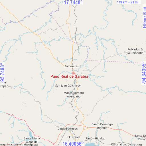
Paso Real de Sarabia GPS coordinates[2]
17° 4' 26.004" North, 95° 2' 48.012" West
| Map corner | latitude | longitude |
|---|---|---|
| Upper-left | 17.7448°, | -95.7498° |
| Center: | 17.07389°, | -95.04667° |
| Lower-right: | 16.40056°, | -94.34355° |
| Map W x H: | 149.5×149.5 km | = 92.9×92.9mi |
| max Lat: | 32.7° ⇑87.9% North |
| Paso Real de Sarabia: | 17.07389° |
| min Lat: | ⇓12.1% South 14.53588° |
| min Long | Paso Real de Sa | max Long |
| -117.105° | -95.04667° | -86.73105° |
| W 84.5%⇐ | ⇒15.5% E |
Elevation
Elevation of Paso Real de Sarabia is 112 m = 367 ft, and this is 1141.7 m = 3746 ft below average elevation for this country.
| Max E: |
3497 m = 11473 ft | 79% |
| Avg. | 1253.7 m = 4113 ft | |
| Paso Real de Sarabia | 112 m = 367 ft | |
Min E: |
-1 m = -3 ft | 21% |
See also: Mexico elevation on elevation.city.
Geographical zone
Paso Real de Sarabia is located in North Torrid zone (between Equator and Tropic of Cancer). Distance of this Northern Tropic circle is 707.5 km =439.6 mi to North.| Distance of | km | miles | from Paso Real de Sarabia |
|---|---|---|---|
| North Pole | 8108.6 | 5038.4 | to North |
| Arctic Circle | 5502.7 | 3419.2 | to North |
| Tropic Cancer | 707.5 | 439.6 | to North |
| Equator | 1898.4 | 1179.6 | to South |


Nearby cities:
15 places around Paso Real de Sarabia: (largest is in red/bold)
• Boca del Monte
3.4 km =2.1 mi,  112°
112°
• Cuauhtémoc
17.4 km =10.8 mi,  79°
79°
• Donaji
17.3 km =10.7 mi,  357°
357°
• El Chocolate
16.4 km =10.2 mi,  196°
196°
• Encinal Colorado
9.6 km =6 mi,  222°
222°
• Estación Mogoñé
8.9 km =5.5 mi,  173°
173°
• Mogoñé Viejo
7.9 km =4.9 mi,  163°
163°
• Nuevo Progreso
7.2 km =4.5 mi, 356°
• Palomares
7.4 km =4.6 mi,  346°
346°
• Piedra Blanca
10.1 km =6.3 mi, 159°
• Río Pachiñe
11.9 km =7.4 mi,  189°
189°
• San Juan Guichicovi
13.4 km =8.3 mi, 202°
• Santa Ana
4.6 km =2.9 mi,  242°
242°
• Tolosita
14.2 km =8.8 mi, 358°
• Zarzal
6.7 km =4.2 mi, 171°
Sources, notices
• [Note1] Compared only with cities in Mexico existing in our database
• [Src1] Map data: © OpenStreetMap contributors (CC-BY-SA)
• [Src2] Other city data from geonames.org with taken over terms of usage.
• [Src3] Geographical zone / Annual Mean Temperature by Robert A. Rohde @ Wikipedia
