San Pedro Totolápam geodata
San Pedro Totolápam (Oaxaca) is a populated place; located in Mexico in America/Mexico_City (GMT-6) time zone. With population of 1,585 people, there are 5445 cities with bigger population in this country. Compared to other cities in Mexico, 93.1% of cities are located further ↑North; 80.8% of cities are located further ←West and 60.7% of cities have higher elevation than San Pedro Totolápam. Note1


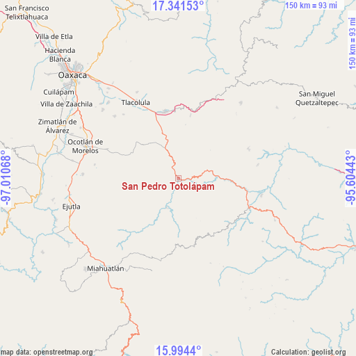
San Pedro Totolápam GPS coordinates[2]
16° 40' 8.94" North, 96° 18' 27.18" West
| Map corner | latitude | longitude |
|---|---|---|
| Upper-left | 17.34153°, | -97.01068° |
| Center: | 16.66915°, | -96.30755° |
| Lower-right: | 15.9944°, | -95.60443° |
| Map W x H: | 149.8×149.8 km | = 93.1×93.1mi |
| max Lat: | 32.7° ⇑93.1% North |
| San Pedro Totolápam: | 16.66915° |
| min Lat: | ⇓6.9% South 14.53588° |
| min Long | San Pedro Totol | max Long |
| -117.105° | -96.30755° | -86.73105° |
| W 80.8%⇐ | ⇒19.2% E |
Elevation
Elevation of San Pedro Totolápam is 961 m = 3153 ft, and this is 292.7 m = 960 ft below average elevation for this country.
| Max E: |
3497 m = 11473 ft | 60.7% |
| Avg. | 1253.7 m = 4113 ft | |
| San Pedro Totolápam | 961 m = 3153 ft | |
Min E: |
-1 m = -3 ft | 39.3% |
See also: Mexico elevation on elevation.city.
Geographical zone
San Pedro Totolápam is located in North Torrid zone (between Equator and Tropic of Cancer). Distance of this Northern Tropic circle is 752.5 km =467.6 mi to North.| Distance of | km | miles | from San Pedro Totolápam |
|---|---|---|---|
| North Pole | 8153.6 | 5066.4 | to North |
| Arctic Circle | 5547.7 | 3447.2 | to North |
| Tropic Cancer | 752.5 | 467.6 | to North |
| Equator | 1853.4 | 1151.6 | to South |


Nearby cities:
15 places around San Pedro Totolápam: (largest is in red/bold)
• Nizagoche
28.1 km =17.5 mi,  188°
188°
• San Baltazar Chichicapam
21.9 km =13.6 mi,  297°
297°
• San Baltazar Guelavila
14.1 km =8.8 mi,  0°
0°
• San Dionisio Ocotepec
17.6 km =10.9 mi,  328°
328°
• San Juan del Río
28.6 km =17.8 mi,  33°
33°
• San Juán Lachigalla
27.4 km =17 mi,  251°
251°
• San Lorenzo Albarradas
27.4 km =17 mi,  11°
11°
• San Pablo Güilá
20.5 km =12.7 mi,  316°
316°
• San Pedro Taviche
24.7 km =15.3 mi,  262°
262°
• Santa María Zoquitlán
13.2 km =8.2 mi,  201°
201°
• Santiago Matatlán
23.2 km =14.4 mi,  339°
339°
• Santiago la Libertad
26.7 km =16.6 mi,  243°
243°
• Santo Tomás de Arriba
14.2 km =8.8 mi, 32°
• Xaaga
26.2 km =16.3 mi,  355°
355°
• Yaxe
18.6 km =11.6 mi,  289°
289°
Sources, notices
• [Note1] Compared only with cities in Mexico existing in our database
• [Src1] Map data: © OpenStreetMap contributors (CC-BY-SA)
• [Src2] Other city data from geonames.org with taken over terms of usage.
• [Src3] Geographical zone / Annual Mean Temperature by Robert A. Rohde @ Wikipedia
