Guamúchil geodata
Guamúchil (Oaxaca) is a populated place; located in Mexico in America/Mexico_City (GMT-6) time zone. With population of 1,828 people, there are 4757 cities with bigger population in this country. Compared to other cities in Mexico, 95.2% of cities are located further ↑North; 85.2% of cities are located further ←West and 97.5% of cities have higher elevation than Guamúchil. Note1


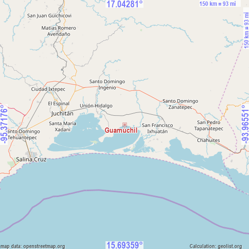
Guamúchil GPS coordinates[2]
16° 22' 9.732" North, 94° 40' 7.068" West
| Map corner | latitude | longitude |
|---|---|---|
| Upper-left | 17.04281°, | -95.37176° |
| Center: | 16.36937°, | -94.66863° |
| Lower-right: | 15.69359°, | -93.96551° |
| Map W x H: | 150×150 km | = 93.2×93.2mi |
| max Lat: | 32.7° ⇑95.2% North |
| Guamúchil: | 16.36937° |
| min Lat: | ⇓4.8% South 14.53588° |
| min Long | Guamúchil | max Long |
| -117.105° | -94.66863° | -86.73105° |
| W 85.2%⇐ | ⇒14.8% E |
Elevation
Elevation of Guamúchil is 9 m = 30 ft, and this is 1244.7 m = 4084 ft below average elevation for this country.
| Max E: |
3497 m = 11473 ft | 97.5% |
| Avg. | 1253.7 m = 4113 ft | |
| Guamúchil | 9 m = 30 ft | |
Min E: |
-1 m = -3 ft | 2.5% |
See also: Mexico elevation on elevation.city.
Geographical zone
Guamúchil is located in North Torrid zone (between Equator and Tropic of Cancer). Distance of this Northern Tropic circle is 785.8 km =488.3 mi to North.| Distance of | km | miles | from Guamúchil |
|---|---|---|---|
| North Pole | 8187 | 5087.2 | to North |
| Arctic Circle | 5581.1 | 3467.9 | to North |
| Tropic Cancer | 785.8 | 488.3 | to North |
| Equator | 1820.1 | 1131 | to South |


Nearby cities:
15 places around Guamúchil: (largest is in red/bold)
• 20 de Noviembre (El Morro)
21.9 km =13.6 mi,  113°
113°
• Cerro Grande
17.9 km =11.1 mi,  126°
126°
• Chicapa de Castro
18.1 km =11.2 mi,  295°
295°
• Huanacastal
24.4 km =15.2 mi,  61°
61°
• La Blanca
25.2 km =15.7 mi,  354°
354°
• Las Amilpas
5.6 km =3.5 mi,  93°
93°
• Niltepec
22.4 km =13.9 mi,  15°
15°
• Reforma de Pineda
22.8 km =14.2 mi,  81°
81°
• San Dionisio del Mar
10.8 km =6.7 mi,  242°
242°
• San Francisco Ixhuatan
19.8 km =12.3 mi,  95°
95°
• San Francisco del Mar
16.7 km =10.4 mi, 101°
• San Francisco del Mar Viejo
15.8 km =9.8 mi,  166°
166°
• Santa María del Mar
25.9 km =16.1 mi,  230°
230°
• Santa Rita (Santa Rita del Mar)
18.3 km =11.4 mi,  122°
122°
• Unión Hidalgo
20.6 km =12.8 mi, 303°
Sources, notices
• [Note1] Compared only with cities in Mexico existing in our database
• [Src1] Map data: © OpenStreetMap contributors (CC-BY-SA)
• [Src2] Other city data from geonames.org with taken over terms of usage.
• [Src3] Geographical zone / Annual Mean Temperature by Robert A. Rohde @ Wikipedia
