Niltepec geodata
Niltepec (Oaxaca) is a populated place; located in Mexico in America/Mexico_City (GMT-6) time zone. With population of 3,289 people, there are 2761 cities with bigger population in this country. Compared to other cities in Mexico, 93.9% of cities are located further ↑North; 85.3% of cities are located further ←West and 82.1% of cities have higher elevation than Niltepec. Note1


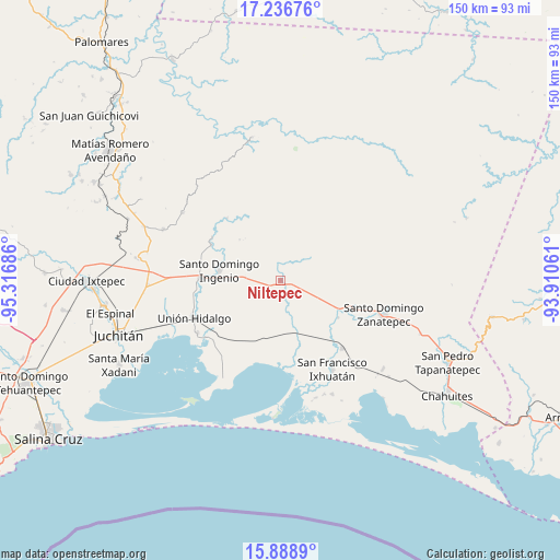
Niltepec GPS coordinates[2]
16° 33' 50.436" North, 94° 36' 49.428" West
| Map corner | latitude | longitude |
|---|---|---|
| Upper-left | 17.23676°, | -95.31686° |
| Center: | 16.56401°, | -94.61373° |
| Lower-right: | 15.8889°, | -93.91061° |
| Map W x H: | 149.9×149.9 km | = 93.1×93.1mi |
| max Lat: | 32.7° ⇑93.9% North |
| Niltepec: | 16.56401° |
| min Lat: | ⇓6.1% South 14.53588° |
| min Long | Niltepec | max Long |
| -117.105° | -94.61373° | -86.73105° |
| W 85.3%⇐ | ⇒14.7% E |
Elevation
Elevation of Niltepec is 69 m = 226 ft, and this is 1184.7 m = 3887 ft below average elevation for this country.
| Max E: |
3497 m = 11473 ft | 82.1% |
| Avg. | 1253.7 m = 4113 ft | |
| Niltepec | 69 m = 226 ft | |
Min E: |
-1 m = -3 ft | 17.9% |
See also: Mexico elevation on elevation.city.
Geographical zone
Niltepec is located in North Torrid zone (between Equator and Tropic of Cancer). Distance of this Northern Tropic circle is 764.2 km =474.9 mi to North.| Distance of | km | miles | from Niltepec |
|---|---|---|---|
| North Pole | 8165.3 | 5073.7 | to North |
| Arctic Circle | 5559.4 | 3454.4 | to North |
| Tropic Cancer | 764.2 | 474.9 | to North |
| Equator | 1841.7 | 1144.4 | to South |


Nearby cities:
15 places around Niltepec: (largest is in red/bold)
• Chicapa de Castro
26.2 km =16.3 mi,  237°
237°
• El Porvenir
20.6 km =12.8 mi,  297°
297°
• Guamúchil
22.4 km =13.9 mi,  195°
195°
• Huanacastal
18.4 km =11.4 mi,  122°
122°
• La Blanca
9.1 km =5.7 mi,  292°
292°
• La Venta
21.8 km =13.5 mi,  272°
272°
• Las Amilpas
21.9 km =13.6 mi,  180°
180°
• Las Conchas
15.4 km =9.6 mi,  315°
315°
• Reforma de Pineda
24.6 km =15.3 mi,  137°
137°
• San Dionisio del Mar
30.8 km =19.1 mi,  209°
209°
• San Francisco Ixhuatan
27.4 km =17 mi,  149°
149°
• San Francisco del Mar
27 km =16.8 mi,  157°
157°
• San Miguel Chimalapa
22 km =13.7 mi, 319°
• Santo Domingo Zanatepec
29.8 km =18.5 mi,  107°
107°
• Unión Hidalgo
25.2 km =15.7 mi,  246°
246°
Sources, notices
• [Note1] Compared only with cities in Mexico existing in our database
• [Src1] Map data: © OpenStreetMap contributors (CC-BY-SA)
• [Src2] Other city data from geonames.org with taken over terms of usage.
• [Src3] Geographical zone / Annual Mean Temperature by Robert A. Rohde @ Wikipedia
