Medellín y Madero Segunda Sección geodata
Medellín y Madero Segunda Sección (Tabasco) is a populated place; located in Mexico in America/Mexico_City (GMT-6) time zone. With population of 7,825 people, there are 1196 cities with bigger population in this country. Compared to other cities in Mexico, 77.4% of cities are located further ↑North; 89.5% of cities are located further ←West and 97.5% of cities have higher elevation than Medellín y Madero Segunda Sección. Note1
Current local time in Medellín y Madero Segunda Sección:
06:46 AM, WednesdayDifference from your time zone: hours


Medellín y Madero Segunda Sección GPS coordinates[2]
18° 6' 48.636" North, 92° 51' 14.4" West
| Map corner | latitude | longitude |
|---|---|---|
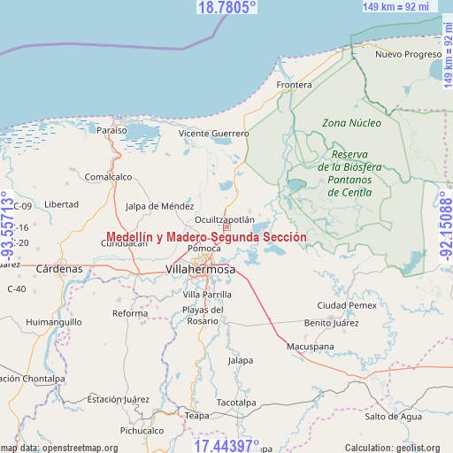
| Upper-left | 18.7805°, | -93.55713° |
| Center: | 18.11351°, | -92.854° |
| Lower-right: | 17.44397°, | -92.15088° |
| Map W x H: | 148.6×148.6 km | = 92.3×92.3mi |
| max Lat: | 32.7° ⇑77.4% North |
| Medellín y Madero Segunda Sección: | 18.11351° |
| min Lat: | ⇓22.6% South 14.53588° |
| min Long | Medellín y Mad | max Long |
| -117.105° | -92.854° | -86.73105° |
| W 89.5%⇐ | ⇒10.5% E |
Elevation
Elevation of Medellín y Madero Segunda Sección is 9 m = 30 ft, and this is 1244.7 m = 4084 ft below average elevation for this country.
| Max E: |
3497 m = 11473 ft | 97.5% |
| Avg. | 1253.7 m = 4113 ft | |
| Medellín y Madero Segunda Sección | 9 m = 30 ft | |
Min E: |
-1 m = -3 ft | 2.5% |
See also: Mexico elevation on elevation.city.
Geographical zone
Medellín y Madero Segunda Sección is located in North Torrid zone (between Equator and Tropic of Cancer). Distance of this Northern Tropic circle is 591.9 km =367.8 mi to North.| Distance of | km | miles | from Medellín y Madero Segunda Sección |
|---|---|---|---|
| North Pole | 7993 | 4966.6 | to North |
| Arctic Circle | 5387.1 | 3347.4 | to North |
| Tropic Cancer | 591.9 | 367.8 | to North |
| Equator | 2014 | 1251.4 | to South |


Nearby cities:
15 places around Medellín y Madero Segunda Sección: (largest is in red/bold)
• Acachapan y Colmena 2da. Sección (La Arena)
8 km =5 mi,  157°
157°
• Banderas (Guatacalca 2da. Sección)
6.4 km =4 mi,  311°
311°
• Constitución
4.9 km =3 mi,  202°
202°
• El Alambrado
8.5 km =5.3 mi,  51°
51°
• El Tigre
9.4 km =5.8 mi,  262°
262°
• Fraccionamiento Ocuiltzapotlán Dos
1.5 km =0.9 mi,  250°
250°
• Francisco I. Madero 1ra. Sección
0.7 km =0.4 mi,  41°
41°
• Jolochero 2da. Sección
5.9 km =3.7 mi,  83°
83°
• La Ceiba
8.7 km =5.4 mi,  66°
66°
• La Loma
8 km =5 mi, 39°
• Lagartera 1ra. Sección
6.6 km =4.1 mi,  210°
210°
• Macultepec
4.2 km =2.6 mi,  349°
349°
• Paso Real de la Victoria
3.4 km =2.1 mi,  320°
320°
• Tamulte de las Sabanas
9.2 km =5.7 mi, 54°
• Tierra Amarilla 3ra. Sección
7.1 km =4.4 mi,  221°
221°
Sources, notices
• [Note1] Compared only with cities in Mexico existing in our database
• [Src1] Map data: © OpenStreetMap contributors (CC-BY-SA)
• [Src2] Other city data from geonames.org with taken over terms of usage.
• [Src3] Geographical zone / Annual Mean Temperature by Robert A. Rohde @ Wikipedia
