Zopo Norte geodata
Zopo Norte (Tabasco) is a populated place; located in Mexico in America/Mexico_City (GMT-6) time zone. With population of 898 people, there are 9712 cities with bigger population in this country. Compared to other cities in Mexico, 81.9% of cities are located further ↑North; 92.5% of cities are located further ←West and 87.5% of cities have higher elevation than Zopo Norte. Note1


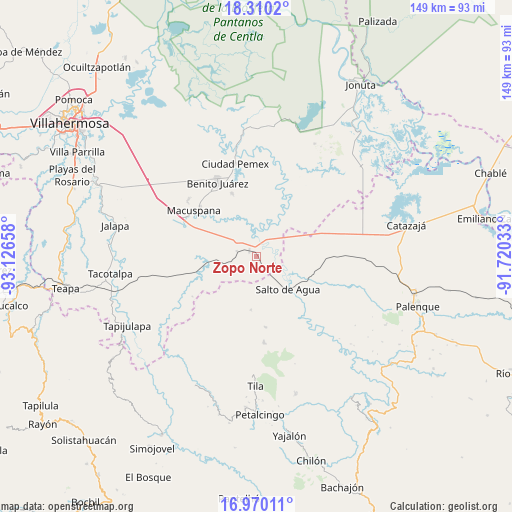
Zopo Norte GPS coordinates[2]
17° 38' 29.04" North, 92° 25' 24.42" West
| Map corner | latitude | longitude |
|---|---|---|
| Upper-left | 18.3102°, | -93.12658° |
| Center: | 17.6414°, | -92.42345° |
| Lower-right: | 16.97011°, | -91.72033° |
| Map W x H: | 149×149 km | = 92.6×92.6mi |
| max Lat: | 32.7° ⇑81.9% North |
| Zopo Norte: | 17.6414° |
| min Lat: | ⇓18.1% South 14.53588° |
| min Long | Zopo Norte | max Long |
| -117.105° | -92.42345° | -86.73105° |
| W 92.5%⇐ | ⇒7.5% E |
Elevation
Elevation of Zopo Norte is 32 m = 105 ft, and this is 1221.7 m = 4008 ft below average elevation for this country.
| Max E: |
3497 m = 11473 ft | 87.5% |
| Avg. | 1253.7 m = 4113 ft | |
| Zopo Norte | 32 m = 105 ft | |
Min E: |
-1 m = -3 ft | 12.5% |
See also: Mexico elevation on elevation.city.
Geographical zone
Zopo Norte is located in North Torrid zone (between Equator and Tropic of Cancer). Distance of this Northern Tropic circle is 644.4 km =400.4 mi to North.| Distance of | km | miles | from Zopo Norte |
|---|---|---|---|
| North Pole | 8045.5 | 4999.2 | to North |
| Arctic Circle | 5439.6 | 3380 | to North |
| Tropic Cancer | 644.4 | 400.4 | to North |
| Equator | 1961.5 | 1218.8 | to South |


Nearby cities:
15 places around Zopo Norte: (largest is in red/bold)
• Alcalde Mayor
14.5 km =9 mi,  54°
54°
• Aquiles Serdán (San Fernando)
19.6 km =12.2 mi,  338°
338°
• Bajadas Grandes
18.4 km =11.4 mi,  68°
68°
• Buena Vista (Apasco)
2.7 km =1.7 mi,  306°
306°
• Cerro Misopa
14.1 km =8.8 mi,  226°
226°
• Francisco Javier Mina (El Coco)
4.7 km =2.9 mi,  330°
330°
• Francisco Villa
14.2 km =8.8 mi,  277°
277°
• Jochinteol
15.3 km =9.5 mi,  169°
169°
• La Ceiba
16 km =9.9 mi,  348°
348°
• Los Luceros 2da. Sección
12.5 km =7.8 mi,  179°
179°
• Palomas
6 km =3.7 mi, 284°
• Paso Chinal
18.7 km =11.6 mi,  210°
210°
• Profesor Caparroso 1ra. Sección
8.3 km =5.2 mi,  255°
255°
• Salto de Agua
13.2 km =8.2 mi,  137°
137°
• Usipa
15.8 km =9.8 mi,  185°
185°
Sources, notices
• [Note1] Compared only with cities in Mexico existing in our database
• [Src1] Map data: © OpenStreetMap contributors (CC-BY-SA)
• [Src2] Other city data from geonames.org with taken over terms of usage.
• [Src3] Geographical zone / Annual Mean Temperature by Robert A. Rohde @ Wikipedia
