Jochinteol geodata
Jochinteol (Chiapas) is a populated place; located in Mexico in America/Mexico_City (GMT-6) time zone. With population of 511 people, there are 16451 cities with bigger population in this country. Compared to other cities in Mexico, 83.1% of cities are located further ↑North; 92.8% of cities are located further ←West and 70.2% of cities have higher elevation than Jochinteol. Note1


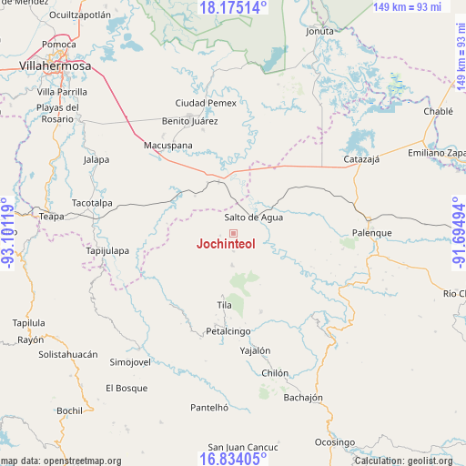
Jochinteol GPS coordinates[2]
17° 30' 20.988" North, 92° 23' 53.016" West
| Map corner | latitude | longitude |
|---|---|---|
| Upper-left | 18.17514°, | -93.10119° |
| Center: | 17.50583°, | -92.39806° |
| Lower-right: | 16.83405°, | -91.69494° |
| Map W x H: | 149.1×149.1 km | = 92.6×92.6mi |
| max Lat: | 32.7° ⇑83.1% North |
| Jochinteol: | 17.50583° |
| min Lat: | ⇓16.9% South 14.53588° |
| min Long | Jochinteol | max Long |
| -117.105° | -92.39806° | -86.73105° |
| W 92.8%⇐ | ⇒7.2% E |
Elevation
Elevation of Jochinteol is 408 m = 1339 ft, and this is 845.7 m = 2775 ft below average elevation for this country.
| Max E: |
3497 m = 11473 ft | 70.2% |
| Avg. | 1253.7 m = 4113 ft | |
| Jochinteol | 408 m = 1339 ft | |
Min E: |
-1 m = -3 ft | 29.8% |
See also: Mexico elevation on elevation.city.
Geographical zone
Jochinteol is located in North Torrid zone (between Equator and Tropic of Cancer). Distance of this Northern Tropic circle is 659.5 km =409.8 mi to North.| Distance of | km | miles | from Jochinteol |
|---|---|---|---|
| North Pole | 8060.6 | 5008.6 | to North |
| Arctic Circle | 5454.7 | 3389.4 | to North |
| Tropic Cancer | 659.5 | 409.8 | to North |
| Equator | 1946.5 | 1209.5 | to South |


Nearby cities:
15 places around Jochinteol: (largest is in red/bold)
• Campanario
6.6 km =4.1 mi,  130°
130°
• Cenobio Aguilar (La Trinidad)
14 km =8.7 mi,  143°
143°
• Cerro Misopa
14 km =8.7 mi,  292°
292°
• El Crucero
16.7 km =10.4 mi,  204°
204°
• El Limar
10.1 km =6.3 mi,  182°
182°
• El Progreso
11.2 km =7 mi,  165°
165°
• Libertad Jolnishtie 2da. Sección
14.6 km =9.1 mi,  234°
234°
• Los Luceros 2da. Sección
3.7 km =2.3 mi,  314°
314°
• Nuevo Limar
5.6 km =3.5 mi, 180°
• Paso Chinal
12.2 km =7.6 mi,  265°
265°
• Profesor Caparroso 1ra. Sección
16.9 km =10.5 mi,  320°
320°
• Salto de Agua
8.2 km =5.1 mi,  49°
49°
• Tza'Quil
14.2 km =8.8 mi,  214°
214°
• Usipa
4.3 km =2.7 mi,  261°
261°
• Zopo Norte
15.3 km =9.5 mi,  349°
349°
Sources, notices
• [Note1] Compared only with cities in Mexico existing in our database
• [Src1] Map data: © OpenStreetMap contributors (CC-BY-SA)
• [Src2] Other city data from geonames.org with taken over terms of usage.
• [Src3] Geographical zone / Annual Mean Temperature by Robert A. Rohde @ Wikipedia
