Alcalde Mayor geodata
Alcalde Mayor (Tabasco) is a populated place; located in Mexico in America/Mexico_City (GMT-6) time zone. With population of 664 people, there are 13077 cities with bigger population in this country. Compared to other cities in Mexico, 81.2% of cities are located further ↑North; 93.3% of cities are located further ←West and 94% of cities have higher elevation than Alcalde Mayor. Note1


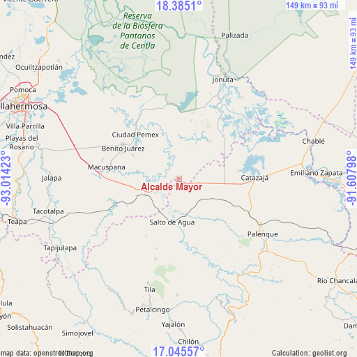
Alcalde Mayor GPS coordinates[2]
17° 42' 59.724" North, 92° 18' 39.96" West
| Map corner | latitude | longitude |
|---|---|---|
| Upper-left | 18.3851°, | -93.01423° |
| Center: | 17.71659°, | -92.3111° |
| Lower-right: | 17.04557°, | -91.60798° |
| Map W x H: | 148.9×148.9 km | = 92.5×92.5mi |
| max Lat: | 32.7° ⇑81.2% North |
| Alcalde Mayor: | 17.71659° |
| min Lat: | ⇓18.8% South 14.53588° |
| min Long | Alcalde Mayor | max Long |
| -117.105° | -92.3111° | -86.73105° |
| W 93.3%⇐ | ⇒6.7% E |
Elevation
Elevation of Alcalde Mayor is 15 m = 49 ft, and this is 1238.7 m = 4064 ft below average elevation for this country.
| Max E: |
3497 m = 11473 ft | 94% |
| Avg. | 1253.7 m = 4113 ft | |
| Alcalde Mayor | 15 m = 49 ft | |
Min E: |
-1 m = -3 ft | 6% |
See also: Mexico elevation on elevation.city.
Geographical zone
Alcalde Mayor is located in North Torrid zone (between Equator and Tropic of Cancer). Distance of this Northern Tropic circle is 636 km =395.2 mi to North.| Distance of | km | miles | from Alcalde Mayor |
|---|---|---|---|
| North Pole | 8037.2 | 4994.1 | to North |
| Arctic Circle | 5431.3 | 3374.9 | to North |
| Tropic Cancer | 636 | 395.2 | to North |
| Equator | 1969.9 | 1224 | to South |


Nearby cities:
15 places around Alcalde Mayor: (largest is in red/bold)
• Aquiles Serdán
8 km =5 mi,  21°
21°
• Aquiles Serdán (San Fernando)
21.3 km =13.2 mi,  297°
297°
• Bajadas Grandes
5.5 km =3.4 mi,  108°
108°
• Buena Vista (Apasco)
15.6 km =9.7 mi,  244°
244°
• El Congo
18.1 km =11.2 mi,  311°
311°
• Emilio Rabasa
15.2 km =9.4 mi,  98°
98°
• Francisco Javier Mina (El Coco)
14.8 km =9.2 mi,  253°
253°
• La Ceiba
16.8 km =10.4 mi, 295°
• Palomas
19 km =11.8 mi, 248°
• Ramón Grande
12.4 km =7.7 mi,  26°
26°
• Salto de Agua
18.3 km =11.4 mi,  189°
189°
• Saturnino Ríos
16.1 km =10 mi,  128°
128°
• Tepetitán
13.2 km =8.2 mi,  330°
330°
• Venustiano Carranza
9.8 km =6.1 mi,  47°
47°
• Zopo Norte
14.5 km =9 mi,  234°
234°
Sources, notices
• [Note1] Compared only with cities in Mexico existing in our database
• [Src1] Map data: © OpenStreetMap contributors (CC-BY-SA)
• [Src2] Other city data from geonames.org with taken over terms of usage.
• [Src3] Geographical zone / Annual Mean Temperature by Robert A. Rohde @ Wikipedia
