Tetla geodata
Tetla (Hidalgo) is a populated place; located in Mexico in America/Mexico_City (GMT-6) time zone. With population of 662 people, there are 13120 cities with bigger population in this country. Compared to other cities in Mexico, 75.2% of cities are located further ↓South; 59.1% of cities are located further ←West and 68.1% of cities have higher elevation than Tetla. Note1


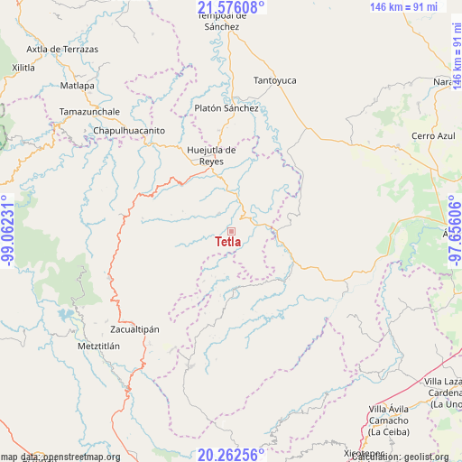
Tetla GPS coordinates[2]
20° 55' 14.736" North, 98° 21' 33.048" West
| Map corner | latitude | longitude |
|---|---|---|
| Upper-left | 21.57608°, | -99.06231° |
| Center: | 20.92076°, | -98.35918° |
| Lower-right: | 20.26256°, | -97.65606° |
| Map W x H: | 146×146.1 km | = 90.7×90.8mi |
| max Lat: | 32.7° ⇑24.8% North |
| Tetla: | 20.92076° |
| min Lat: | ⇓75.2% South 14.53588° |
| min Long | Tetla | max Long |
| -117.105° | -98.35918° | -86.73105° |
| W 59.1%⇐ | ⇒40.9% E |
Elevation
Elevation of Tetla is 526 m = 1726 ft, and this is 727.7 m = 2387 ft below average elevation for this country.
| Max E: |
3497 m = 11473 ft | 68.1% |
| Avg. | 1253.7 m = 4113 ft | |
| Tetla | 526 m = 1726 ft | |
Min E: |
-1 m = -3 ft | 31.9% |
See also: Mexico elevation on elevation.city.
Geographical zone
Tetla is located in North Torrid zone (between Equator and Tropic of Cancer). Distance of this Northern Tropic circle is 279.7 km =173.8 mi to North.| Distance of | km | miles | from Tetla |
|---|---|---|---|
| North Pole | 7680.9 | 4772.7 | to North |
| Arctic Circle | 5075 | 3153.5 | to North |
| Tropic Cancer | 279.7 | 173.8 | to North |
| Equator | 2326.2 | 1445.4 | to South |


Nearby cities:
15 places around Tetla: (largest is in red/bold)
• Achiquihuixtla
6.8 km =4.2 mi,  353°
353°
• Chiapa
6.9 km =4.3 mi,  129°
129°
• Chiatitla
3.2 km =2 mi,  120°
120°
• Mecatlán
4.9 km =3 mi,  290°
290°
• Oxeloco
3.5 km =2.2 mi,  93°
93°
• Pahactla
6 km =3.7 mi,  2°
2°
• Pepeyocatitla
4 km =2.5 mi,  259°
259°
• Pohuantitla
7.6 km =4.7 mi,  139°
139°
• Santa Teresa
4.2 km =2.6 mi,  216°
216°
• Tecacahuaco
3.1 km =1.9 mi,  42°
42°
• Tenamaxtepec
4.2 km =2.6 mi,  183°
183°
• Tepetitla
5.2 km =3.2 mi,  330°
330°
• Tlalchiyahualica
7 km =4.3 mi,  322°
322°
• Yahualica
4.3 km =2.7 mi, 329°
• Zoquitipán
7.7 km =4.8 mi, 260°
Sources, notices
• [Note1] Compared only with cities in Mexico existing in our database
• [Src1] Map data: © OpenStreetMap contributors (CC-BY-SA)
• [Src2] Other city data from geonames.org with taken over terms of usage.
• [Src3] Geographical zone / Annual Mean Temperature by Robert A. Rohde @ Wikipedia
