Benito Juárez geodata
Benito Juárez (Hidalgo) is a populated place; located in Mexico in America/Mexico_City (GMT-6) time zone. With population of 1,197 people, there are 7253 cities with bigger population in this country. Compared to other cities in Mexico, 60.5% of cities are located further ↓South; 53.2% of cities are located further ←West and 91.9% of cities have lower elevation than Benito Juárez. Note1


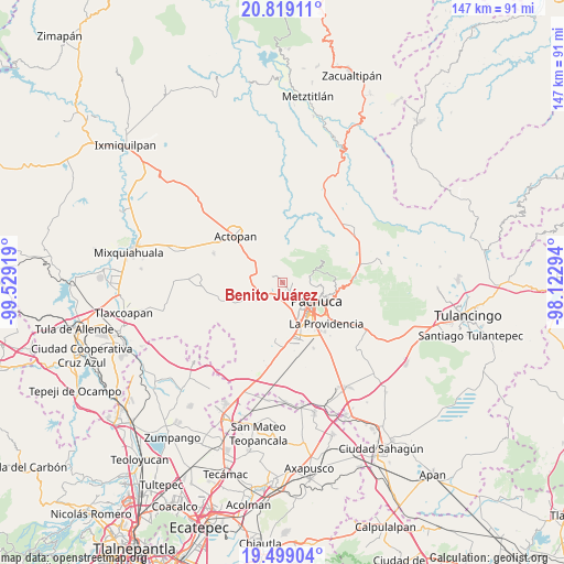
Benito Juárez GPS coordinates[2]
20° 9' 37.692" North, 98° 49' 33.816" West
| Map corner | latitude | longitude |
|---|---|---|
| Upper-left | 20.81911°, | -99.52919° |
| Center: | 20.16047°, | -98.82606° |
| Lower-right: | 19.49904°, | -98.12294° |
| Map W x H: | 146.8×146.8 km | = 91.2×91.2mi |
| max Lat: | 32.7° ⇑39.5% North |
| Benito Juárez: | 20.16047° |
| min Lat: | ⇓60.5% South 14.53588° |
| min Long | Benito Juárez | max Long |
| -117.105° | -98.82606° | -86.73105° |
| W 53.2%⇐ | ⇒46.8% E |
Elevation
Elevation of Benito Juárez is 2478 m = 8130 ft, and this is 1224.3 m = 4017 ft above average elevation for this country.
| Max E: |
3497 m = 11473 ft | 8.1% |
| Benito Juárez | 2478 m 8130 ft | |
| Avg. | 1253.7 m = 4113 ft | |
Min E: |
-1 m = -3 ft | 91.9% |
See also: Mexico elevation on elevation.city.
Geographical zone
Benito Juárez is located in North Torrid zone (between Equator and Tropic of Cancer). Distance of this Northern Tropic circle is 364.3 km =226.4 mi to North.| Distance of | km | miles | from Benito Juárez |
|---|---|---|---|
| North Pole | 7765.4 | 4825.2 | to North |
| Arctic Circle | 5159.5 | 3206 | to North |
| Tropic Cancer | 364.3 | 226.4 | to North |
| Equator | 2241.6 | 1392.9 | to South |


Nearby cities:
15 places around Benito Juárez: (largest is in red/bold)
• Banús
3.8 km =2.4 mi,  147°
147°
• Barrio de Españita
3.4 km =2.1 mi,  241°
241°
• El Botho
6.8 km =4.2 mi,  249°
249°
• El Durazno
4.6 km =2.9 mi,  220°
220°
• El Huixmí
9.4 km =5.8 mi,  175°
175°
• La Estanzuela
7.5 km =4.7 mi,  74°
74°
• La Manzana Uno
9.8 km =6.1 mi,  297°
297°
• La Sala (La Caliente)
7.1 km =4.4 mi,  317°
317°
• Pachuca de Soto
10.8 km =6.7 mi,  116°
116°
• San Agustín Tlaxiaca
8.1 km =5 mi,  231°
231°
• San Jerónimo
8.5 km =5.3 mi,  345°
345°
• San Juan Tilcuautla
2.6 km =1.6 mi,  94°
94°
• San Miguel Cerezo (El Cerezo)
10.2 km =6.3 mi, 90°
• Santa Gertrudis (Colonia Santa Gertrudis)
8.4 km =5.2 mi,  166°
166°
• Santiago Tlapacoya
5.7 km =3.5 mi, 184°
Sources, notices
• [Note1] Compared only with cities in Mexico existing in our database
• [Src1] Map data: © OpenStreetMap contributors (CC-BY-SA)
• [Src2] Other city data from geonames.org with taken over terms of usage.
• [Src3] Geographical zone / Annual Mean Temperature by Robert A. Rohde @ Wikipedia
