Banús geodata
Banús (Hidalgo) is a populated place; located in Mexico in America/Mexico_City (GMT-6) time zone. With population of 555 people, there are 15371 cities with bigger population in this country. Compared to other cities in Mexico, 59.8% of cities are located further ↓South; 53.5% of cities are located further ←West and 91.5% of cities have lower elevation than Banús. Note1


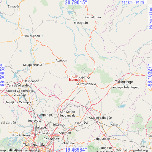
Banús GPS coordinates[2]
20° 7' 53.004" North, 98° 48' 23.004" West
| Map corner | latitude | longitude |
|---|---|---|
| Upper-left | 20.79015°, | -99.50952° |
| Center: | 20.13139°, | -98.80639° |
| Lower-right: | 19.46984°, | -98.10327° |
| Map W x H: | 146.8×146.8 km | = 91.2×91.2mi |
| max Lat: | 32.7° ⇑40.2% North |
| Banús: | 20.13139° |
| min Lat: | ⇓59.8% South 14.53588° |
| min Long | Banús | max Long |
| -117.105° | -98.80639° | -86.73105° |
| W 53.5%⇐ | ⇒46.5% E |
Elevation
Elevation of Banús is 2458 m = 8064 ft, and this is 1204.3 m = 3951 ft above average elevation for this country.
| Max E: |
3497 m = 11473 ft | 8.5% |
| Banús | 2458 m 8064 ft | |
| Avg. | 1253.7 m = 4113 ft | |
Min E: |
-1 m = -3 ft | 91.5% |
See also: Mexico elevation on elevation.city.
Geographical zone
Banús is located in North Torrid zone (between Equator and Tropic of Cancer). Distance of this Northern Tropic circle is 367.5 km =228.4 mi to North.| Distance of | km | miles | from Banús |
|---|---|---|---|
| North Pole | 7768.7 | 4827.2 | to North |
| Arctic Circle | 5162.8 | 3208 | to North |
| Tropic Cancer | 367.5 | 228.4 | to North |
| Equator | 2238.4 | 1390.9 | to South |


Nearby cities:
15 places around Banús: (largest is in red/bold)
• Barrio de Españita
5.3 km =3.3 mi,  287°
287°
• Benito Juárez
3.8 km =2.4 mi,  327°
327°
• El Botho
8.5 km =5.3 mi,  275°
275°
• El Durazno
5 km =3.1 mi,  267°
267°
• El Huixmí
6.3 km =3.9 mi,  192°
192°
• La Estanzuela
7.3 km =4.5 mi,  44°
44°
• Pachuca de Soto
7.8 km =4.8 mi,  101°
101°
• Privada Quinta Bonita
8.3 km =5.2 mi,  153°
153°
• Rinconadas de San Francisco
8.3 km =5.2 mi, 151°
• San Agustín Tlaxiaca
8.5 km =5.3 mi,  257°
257°
• San Juan Tilcuautla
3.1 km =1.9 mi,  10°
10°
• San Miguel Cerezo (El Cerezo)
8.7 km =5.4 mi,  69°
69°
• Santa Gertrudis (Colonia Santa Gertrudis)
5 km =3.1 mi,  180°
180°
• Santiago Tlapacoya
3.5 km =2.2 mi,  225°
225°
• Unidad Habitacional Dina-Sidena Chacón
8.8 km =5.5 mi,  127°
127°
Sources, notices
• [Note1] Compared only with cities in Mexico existing in our database
• [Src1] Map data: © OpenStreetMap contributors (CC-BY-SA)
• [Src2] Other city data from geonames.org with taken over terms of usage.
• [Src3] Geographical zone / Annual Mean Temperature by Robert A. Rohde @ Wikipedia
