Cañada geodata
Cañada (Hidalgo) is a populated place; located in Mexico in America/Mexico_City (GMT-6) time zone. With population of 1,397 people, there are 6196 cities with bigger population in this country. Compared to other cities in Mexico, 56.9% of cities are located further ↓South; 53.5% of cities are located further →East and 81.8% of cities have lower elevation than Cañada. Note1


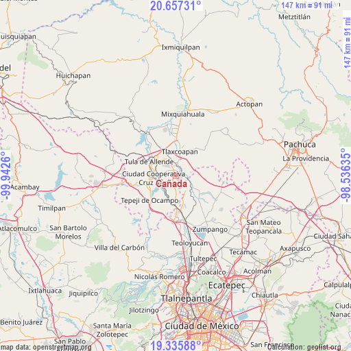
Cañada GPS coordinates[2]
19° 59' 52.728" North, 99° 14' 22.092" West
| Map corner | latitude | longitude |
|---|---|---|
| Upper-left | 20.65731°, | -99.9426° |
| Center: | 19.99798°, | -99.23947° |
| Lower-right: | 19.33588°, | -98.53635° |
| Map W x H: | 146.9×146.9 km | = 91.3×91.3mi |
| max Lat: | 32.7° ⇑43.1% North |
| Cañada: | 19.99798° |
| min Lat: | ⇓56.9% South 14.53588° |
| min Long | Cañada | max Long |
| -117.105° | -99.23947° | -86.73105° |
| W 46.5%⇐ | ⇒53.5% E |
Elevation
Elevation of Cañada is 2183 m = 7162 ft, and this is 929.3 m = 3049 ft above average elevation for this country.
| Max E: |
3497 m = 11473 ft | 18.2% |
| Cañada | 2183 m 7162 ft | |
| Avg. | 1253.7 m = 4113 ft | |
Min E: |
-1 m = -3 ft | 81.8% |
See also: Mexico elevation on elevation.city.
Geographical zone
Cañada is located in North Torrid zone (between Equator and Tropic of Cancer). Distance of this Northern Tropic circle is 382.4 km =237.6 mi to North.| Distance of | km | miles | from Cañada |
|---|---|---|---|
| North Pole | 7783.5 | 4836.4 | to North |
| Arctic Circle | 5177.6 | 3217.2 | to North |
| Tropic Cancer | 382.4 | 237.6 | to North |
| Equator | 2223.6 | 1381.7 | to South |


Nearby cities:
15 places around Cañada: (largest is in red/bold)
• Atotonilco de Tula
2.5 km =1.6 mi,  64°
64°
• Bomintzha
3.9 km =2.4 mi,  297°
297°
• Cardonal
6.6 km =4.1 mi,  8°
8°
• Colonia el Pixquay (Colonia el Carmen)
6.5 km =4 mi,  125°
125°
• Conejos
2.5 km =1.6 mi,  189°
189°
• El Pedregal
7 km =4.3 mi,  176°
176°
• El Refugio
5.4 km =3.4 mi,  81°
81°
• Ocampo
1.2 km =0.7 mi,  1°
1°
• Progreso
2.4 km =1.5 mi, 2°
• San Antonio
7 km =4.3 mi,  225°
225°
• Texas
5.5 km =3.4 mi, 56°
• Tlamaco (San Gerónimo Tlamaco)
4.2 km =2.6 mi, 14°
• Unidad Habitacional Antonio Osorio de León (Bojay)
5.1 km =3.2 mi,  353°
353°
• Vito
4.3 km =2.7 mi,  101°
101°
• Zacamulpa
2 km =1.2 mi, 295°
Sources, notices
• [Note1] Compared only with cities in Mexico existing in our database
• [Src1] Map data: © OpenStreetMap contributors (CC-BY-SA)
• [Src2] Other city data from geonames.org with taken over terms of usage.
• [Src3] Geographical zone / Annual Mean Temperature by Robert A. Rohde @ Wikipedia
