Tlamaco (San Gerónimo Tlamaco) geodata
Tlamaco (San Gerónimo Tlamaco) (Hidalgo) is a populated place; located in Mexico in America/Mexico_City (GMT-6) time zone. With population of 3,285 people, there are 2764 cities with bigger population in this country. Compared to other cities in Mexico, 57.7% of cities are located further ↓South; 53.3% of cities are located further →East and 79.7% of cities have lower elevation than Tlamaco (San Gerónimo Tlamaco). Note1
Current local time in Tlamaco (San Gerónimo Tlamaco):
05:30 AM, WednesdayDifference from your time zone: hours


Tlamaco (San Gerónimo Tlamaco) GPS coordinates[2]
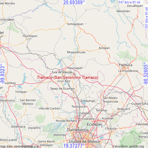
20° 2' 4.992" North, 99° 13' 45.012" West
| Map corner | latitude | longitude |
|---|---|---|
| Upper-left | 20.69389°, | -99.9323° |
| Center: | 20.03472°, | -99.22917° |
| Lower-right: | 19.37277°, | -98.52605° |
| Map W x H: | 146.9×146.9 km | = 91.3×91.3mi |
| max Lat: | 32.7° ⇑42.3% North |
| Tlamaco (San Gerónimo Tlamaco): | 20.03472° |
| min Lat: | ⇓57.7% South 14.53588° |
| min Long | Tlamaco (San Ge | max Long |
| -117.105° | -99.22917° | -86.73105° |
| W 46.7%⇐ | ⇒53.3% E |
Elevation
Elevation of Tlamaco (San Gerónimo Tlamaco) is 2134 m = 7001 ft, and this is 880.3 m = 2888 ft above average elevation for this country.
| Max E: |
3497 m = 11473 ft | 20.3% |
| Tlamaco (San Gerónimo Tlamaco) | 2134 m 7001 ft | |
| Avg. | 1253.7 m = 4113 ft | |
Min E: |
-1 m = -3 ft | 79.7% |
See also: Mexico elevation on elevation.city.
Geographical zone
Tlamaco (San Gerónimo Tlamaco) is located in North Torrid zone (between Equator and Tropic of Cancer). Distance of this Northern Tropic circle is 378.3 km =235.1 mi to North.| Distance of | km | miles | from Tlamaco (San Gerónimo Tlamaco) |
|---|---|---|---|
| North Pole | 7779.4 | 4833.9 | to North |
| Arctic Circle | 5173.5 | 3214.7 | to North |
| Tropic Cancer | 378.3 | 235.1 | to North |
| Equator | 2227.7 | 1384.2 | to South |


Nearby cities:
15 places around Tlamaco (San Gerónimo Tlamaco): (largest is in red/bold)
• Atitalaquia
2.9 km =1.8 mi,  15°
15°
• Atotonilco de Tula
3.2 km =2 mi,  158°
158°
• Bomintzha
5.1 km =3.2 mi,  243°
243°
• Cardonal
2.5 km =1.6 mi,  357°
357°
• Cañada
4.2 km =2.6 mi,  194°
194°
• El Refugio
5.4 km =3.4 mi,  127°
127°
• Ocampo
3.1 km =1.9 mi,  200°
200°
• Progreso
1.9 km =1.2 mi,  210°
210°
• Texas
3.7 km =2.3 mi,  106°
106°
• Tezoquipa
3.5 km =2.2 mi,  46°
46°
• Tlalminulpa
4.5 km =2.8 mi,  9°
9°
• Tlaxcoapan
6.4 km =4 mi, 8°
• Unidad Habitacional Antonio Osorio de León (Bojay)
1.9 km =1.2 mi,  302°
302°
• Vito
5.9 km =3.7 mi,  147°
147°
• Zacamulpa
4.3 km =2.7 mi,  222°
222°
Sources, notices
• [Note1] Compared only with cities in Mexico existing in our database
• [Src1] Map data: © OpenStreetMap contributors (CC-BY-SA)
• [Src2] Other city data from geonames.org with taken over terms of usage.
• [Src3] Geographical zone / Annual Mean Temperature by Robert A. Rohde @ Wikipedia
