Atlangatepec geodata
Atlangatepec (Tlaxcala) is a seat of a second-order administrative division; located in Mexico in America/Mexico_City (GMT-6) time zone. With population of 480 people, there are 16821 cities with bigger population in this country. Compared to other cities in Mexico, 53.4% of cities are located further ↑North; 61.1% of cities are located further ←West and 92.5% of cities have lower elevation than Atlangatepec. Note1


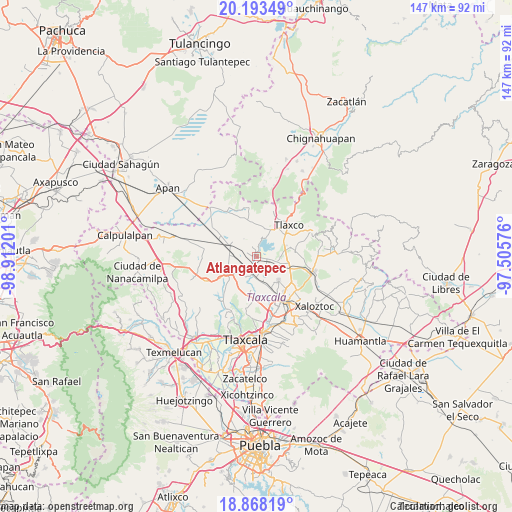
Atlangatepec GPS coordinates[2]
19° 31' 55.92" North, 98° 12' 31.968" West
| Map corner | latitude | longitude |
|---|---|---|
| Upper-left | 20.19349°, | -98.91201° |
| Center: | 19.5322°, | -98.20888° |
| Lower-right: | 18.86819°, | -97.50576° |
| Map W x H: | 147.4×147.4 km | = 91.6×91.6mi |
| max Lat: | 32.7° ⇑53.4% North |
| Atlangatepec: | 19.5322° |
| min Lat: | ⇓46.6% South 14.53588° |
| min Long | Atlangatepec | max Long |
| -117.105° | -98.20888° | -86.73105° |
| W 61.1%⇐ | ⇒38.9% E |
Elevation
Elevation of Atlangatepec is 2507 m = 8225 ft, and this is 1253.3 m = 4112 ft above average elevation for this country.
| Max E: |
3497 m = 11473 ft | 7.5% |
| Atlangatepec | 2507 m 8225 ft | |
| Avg. | 1253.7 m = 4113 ft | |
Min E: |
-1 m = -3 ft | 92.5% |
See also: Mexico elevation on elevation.city.
Geographical zone
Atlangatepec is located in North Torrid zone (between Equator and Tropic of Cancer). Distance of this Northern Tropic circle is 434.1 km =269.7 mi to North.| Distance of | km | miles | from Atlangatepec |
|---|---|---|---|
| North Pole | 7835.3 | 4868.6 | to North |
| Arctic Circle | 5229.4 | 3249.4 | to North |
| Tropic Cancer | 434.1 | 269.7 | to North |
| Equator | 2171.8 | 1349.5 | to South |


Nearby cities:
15 places around Atlangatepec: (largest is in red/bold)
• Atexcatzingo
9.6 km =6 mi,  137°
137°
• Barrio de Cuatla
9.9 km =6.2 mi,  183°
183°
• Guadalupe Cuauhtémoc
3.5 km =2.2 mi,  243°
243°
• José María Morelos
9.1 km =5.7 mi, 144°
• Muñoz
6.4 km =4 mi, 180°
• San José Cuamantzingo
5.1 km =3.2 mi,  248°
248°
• San José Tepeyahualco
9.8 km =6.1 mi,  319°
319°
• San José Tetel
12.2 km =7.6 mi,  154°
154°
• San Lucas Tecopilco
7.1 km =4.4 mi,  224°
224°
• San Pedro Ecatepec
5.8 km =3.6 mi,  101°
101°
• San Simeón Xipetzingo
10.5 km =6.5 mi, 236°
• Santa Bárbara Acuicultzcatepec
9.7 km =6 mi,  189°
189°
• Santiago Tlalpan
12.2 km =7.6 mi, 239°
• Xaltocan
12 km =7.5 mi, 180°
• Zumpango
3.3 km =2.1 mi,  330°
330°
Sources, notices
• [Note1] Compared only with cities in Mexico existing in our database
• [Src1] Map data: © OpenStreetMap contributors (CC-BY-SA)
• [Src2] Other city data from geonames.org with taken over terms of usage.
• [Src3] Geographical zone / Annual Mean Temperature by Robert A. Rohde @ Wikipedia
