San Felipe Hidalgo geodata
San Felipe Hidalgo (Puebla) is a populated place; located in Mexico in America/Mexico_City (GMT-6) time zone. With population of 1,549 people, there are 5567 cities with bigger population in this country. Compared to other cities in Mexico, 54.8% of cities are located further ↑North; 56.5% of cities are located further ←West and 98.8% of cities have lower elevation than San Felipe Hidalgo. Note1


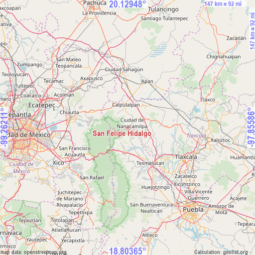
San Felipe Hidalgo GPS coordinates[2]
19° 28' 4.512" North, 98° 33' 32.328" West
| Map corner | latitude | longitude |
|---|---|---|
| Upper-left | 20.12948°, | -99.26211° |
| Center: | 19.46792°, | -98.55898° |
| Lower-right: | 18.80365°, | -97.85586° |
| Map W x H: | 147.4×147.4 km | = 91.6×91.6mi |
| max Lat: | 32.7° ⇑54.8% North |
| San Felipe Hidalgo: | 19.46792° |
| min Lat: | ⇓45.2% South 14.53588° |
| min Long | San Felipe Hida | max Long |
| -117.105° | -98.55898° | -86.73105° |
| W 56.5%⇐ | ⇒43.5% E |
Elevation
Elevation of San Felipe Hidalgo is 2818 m = 9245 ft, and this is 1564.3 m = 5132 ft above average elevation for this country.
| Max E: |
3497 m = 11473 ft | 1.2% |
| San Felipe Hidalgo | 2818 m 9245 ft | |
| Avg. | 1253.7 m = 4113 ft | |
Min E: |
-1 m = -3 ft | 98.8% |
See also: Mexico elevation on elevation.city.
Geographical zone
San Felipe Hidalgo is located in North Torrid zone (between Equator and Tropic of Cancer). Distance of this Northern Tropic circle is 441.3 km =274.2 mi to North.| Distance of | km | miles | from San Felipe Hidalgo |
|---|---|---|---|
| North Pole | 7842.4 | 4873 | to North |
| Arctic Circle | 5236.5 | 3253.8 | to North |
| Tropic Cancer | 441.3 | 274.2 | to North |
| Equator | 2164.6 | 1345 | to South |


Nearby cities:
15 places around San Felipe Hidalgo: (largest is in red/bold)
• Ciudad de Nanacamilpa
3.7 km =2.3 mi,  39°
39°
• Domingo Arenas (La Calera)
10.4 km =6.5 mi,  58°
58°
• Francisco I. Madero
9.3 km =5.8 mi,  50°
50°
• Guadalupito las Dalias
6.8 km =4.2 mi,  148°
148°
• Ignacio Manuel Altamirano
11.5 km =7.1 mi,  192°
192°
• La Magdalena Cuextotitla
11.7 km =7.3 mi,  89°
89°
• La Preciosita
6.8 km =4.2 mi,  166°
166°
• La Soledad
10 km =6.2 mi,  321°
321°
• Mazapa
8.1 km =5 mi,  1°
1°
• San Juan Cuauhtémoc
9.7 km =6 mi,  204°
204°
• San Pedro Matamoros
10.9 km =6.8 mi,  177°
177°
• Sanctórum
9.6 km =6 mi,  72°
72°
• Santa Cruz Moxolahuac
2.7 km =1.7 mi, 146°
• Santiago Coltzingo
9.8 km =6.1 mi,  164°
164°
• Vicente Guerrero
8.8 km =5.5 mi,  125°
125°
Sources, notices
• [Note1] Compared only with cities in Mexico existing in our database
• [Src1] Map data: © OpenStreetMap contributors (CC-BY-SA)
• [Src2] Other city data from geonames.org with taken over terms of usage.
• [Src3] Geographical zone / Annual Mean Temperature by Robert A. Rohde @ Wikipedia
