La Trinidad Tenexyecac geodata
La Trinidad Tenexyecac (Tlaxcala) is a populated place; located in Mexico in America/Mexico_City (GMT-6) time zone. With population of 2,863 people, there are 3107 cities with bigger population in this country. Compared to other cities in Mexico, 57.9% of cities are located further ↑North; 59.6% of cities are located further ←West and 83.7% of cities have lower elevation than La Trinidad Tenexyecac. Note1
Current local time in La Trinidad Tenexyecac:
03:42 AM, WednesdayDifference from your time zone: hours


La Trinidad Tenexyecac GPS coordinates[2]
19° 20' 9.456" North, 98° 18' 53.136" West
| Map corner | latitude | longitude |
|---|---|---|
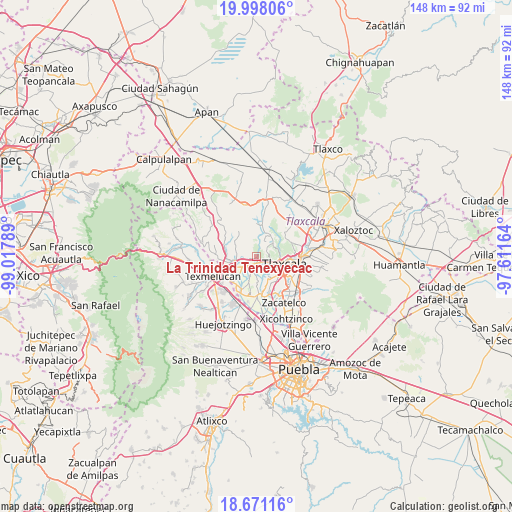
| Upper-left | 19.99806°, | -99.01789° |
| Center: | 19.33596°, | -98.31476° |
| Lower-right: | 18.67116°, | -97.61164° |
| Map W x H: | 147.5×147.5 km | = 91.7×91.7mi |
| max Lat: | 32.7° ⇑57.9% North |
| La Trinidad Tenexyecac: | 19.33596° |
| min Lat: | ⇓42.1% South 14.53588° |
| min Long | La Trinidad Ten | max Long |
| -117.105° | -98.31476° | -86.73105° |
| W 59.6%⇐ | ⇒40.4% E |
Elevation
Elevation of La Trinidad Tenexyecac is 2236 m = 7336 ft, and this is 982.3 m = 3223 ft above average elevation for this country.
| Max E: |
3497 m = 11473 ft | 16.3% |
| La Trinidad Tenexyecac | 2236 m 7336 ft | |
| Avg. | 1253.7 m = 4113 ft | |
Min E: |
-1 m = -3 ft | 83.7% |
See also: Mexico elevation on elevation.city.
Geographical zone
La Trinidad Tenexyecac is located in North Torrid zone (between Equator and Tropic of Cancer). Distance of this Northern Tropic circle is 456 km =283.3 mi to North.| Distance of | km | miles | from La Trinidad Tenexyecac |
|---|---|---|---|
| North Pole | 7857.1 | 4882.2 | to North |
| Arctic Circle | 5251.2 | 3262.9 | to North |
| Tropic Cancer | 456 | 283.3 | to North |
| Equator | 2150 | 1335.9 | to South |


Nearby cities:
15 places around La Trinidad Tenexyecac: (largest is in red/bold)
• Fraccionamiento la Virgen
4.5 km =2.8 mi,  108°
108°
• Panotla
5.2 km =3.2 mi,  115°
115°
• San Ambrosio Texantla
6.5 km =4 mi,  70°
70°
• San Antonio Tecoac
1.4 km =0.9 mi,  240°
240°
• San Francisco Temetzontla
3.2 km =2 mi,  59°
59°
• San Francisco Tenexyecac
6.4 km =4 mi,  180°
180°
• San Jorge Tezoquipan
1.7 km =1.1 mi,  174°
174°
• Santa Ana Nopalucan
4.6 km =2.9 mi,  204°
204°
• Santa Cruz el Porvenir
3.5 km =2.2 mi,  262°
262°
• Santa Inés Tecuexcomac
5.8 km =3.6 mi,  215°
215°
• Santa Justina Ecatepec
5.1 km =3.2 mi, 236°
• Santiago Xochimilco
1.4 km =0.9 mi,  291°
291°
• Totolac
6 km =3.7 mi,  100°
100°
• Unidad Habitacional II
3.7 km =2.3 mi, 110°
• Zaragoza
5.7 km =3.5 mi, 109°
Sources, notices
• [Note1] Compared only with cities in Mexico existing in our database
• [Src1] Map data: © OpenStreetMap contributors (CC-BY-SA)
• [Src2] Other city data from geonames.org with taken over terms of usage.
• [Src3] Geographical zone / Annual Mean Temperature by Robert A. Rohde @ Wikipedia
