Zaragoza geodata
Zaragoza (Tlaxcala) is a populated place; located in Mexico in America/Mexico_City (GMT-6) time zone. With population of 1,548 people, there are 5570 cities with bigger population in this country. Compared to other cities in Mexico, 58.4% of cities are located further ↑North; 60.4% of cities are located further ←West and 84% of cities have lower elevation than Zaragoza. Note1


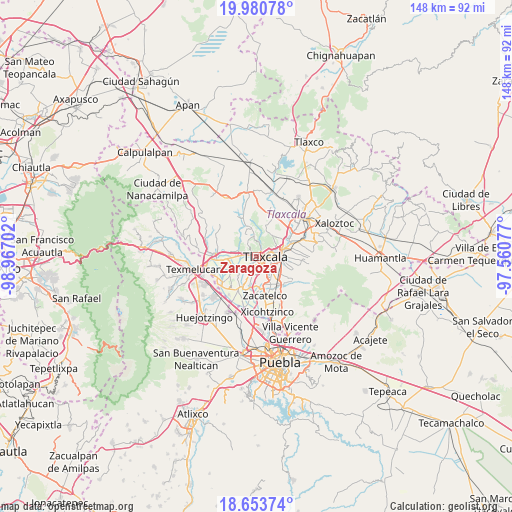
Zaragoza GPS coordinates[2]
19° 19' 6.996" North, 98° 15' 50.004" West
| Map corner | latitude | longitude |
|---|---|---|
| Upper-left | 19.98078°, | -98.96702° |
| Center: | 19.31861°, | -98.26389° |
| Lower-right: | 18.65374°, | -97.56077° |
| Map W x H: | 147.6×147.6 km | = 91.7×91.7mi |
| max Lat: | 32.7° ⇑58.4% North |
| Zaragoza: | 19.31861° |
| min Lat: | ⇓41.6% South 14.53588° |
| min Long | Zaragoza | max Long |
| -117.105° | -98.26389° | -86.73105° |
| W 60.4%⇐ | ⇒39.6% E |
Elevation
Elevation of Zaragoza is 2242 m = 7356 ft, and this is 988.3 m = 3242 ft above average elevation for this country.
| Max E: |
3497 m = 11473 ft | 16% |
| Zaragoza | 2242 m 7356 ft | |
| Avg. | 1253.7 m = 4113 ft | |
Min E: |
-1 m = -3 ft | 84% |
See also: Mexico elevation on elevation.city.
Geographical zone
Zaragoza is located in North Torrid zone (between Equator and Tropic of Cancer). Distance of this Northern Tropic circle is 457.9 km =284.5 mi to North.| Distance of | km | miles | from Zaragoza |
|---|---|---|---|
| North Pole | 7859 | 4883.4 | to North |
| Arctic Circle | 5253.1 | 3264.1 | to North |
| Tropic Cancer | 457.9 | 284.5 | to North |
| Equator | 2148 | 1334.7 | to South |


Nearby cities:
15 places around Zaragoza: (largest is in red/bold)
• Acxotla del Río
2.8 km =1.7 mi,  77°
77°
• Fraccionamiento la Virgen
1.2 km =0.7 mi,  295°
295°
• La Candelaria Teotlalpan
4.3 km =2.7 mi,  68°
68°
• La Trinidad Chimalpa
2.3 km =1.4 mi,  58°
58°
• Los Reyes Quiahuixtlan
2.7 km =1.7 mi,  29°
29°
• Panotla
0.7 km =0.4 mi,  247°
247°
• San Ambrosio Texantla
4.2 km =2.6 mi,  10°
10°
• San Buenaventura Atempan
4.5 km =2.8 mi, 78°
• San Damián Texoloc
5 km =3.1 mi,  206°
206°
• San Francisco Temetzontla
4.4 km =2.7 mi,  323°
323°
• San Hipólito Chimalpa
1.5 km =0.9 mi,  85°
85°
• San Miguel Tlamahuco
2.6 km =1.6 mi, 76°
• Santiago Tepeticpac
4.3 km =2.7 mi, 65°
• Totolac
1 km =0.6 mi,  36°
36°
• Unidad Habitacional II
1.9 km =1.2 mi,  289°
289°
Sources, notices
• [Note1] Compared only with cities in Mexico existing in our database
• [Src1] Map data: © OpenStreetMap contributors (CC-BY-SA)
• [Src2] Other city data from geonames.org with taken over terms of usage.
• [Src3] Geographical zone / Annual Mean Temperature by Robert A. Rohde @ Wikipedia
