Los Reyes Quiahuixtlan geodata
Los Reyes Quiahuixtlan (Tlaxcala) is a populated place; located in Mexico in America/Mexico_City (GMT-6) time zone. With population of 2,342 people, there are 3768 cities with bigger population in this country. Compared to other cities in Mexico, 57.9% of cities are located further ↑North; 60.5% of cities are located further ←West and 86.1% of cities have lower elevation than Los Reyes Quiahuixtlan. Note1
Current local time in Los Reyes Quiahuixtlan:
08:33 AM, WednesdayDifference from your time zone: hours


Los Reyes Quiahuixtlan GPS coordinates[2]
19° 20' 22.38" North, 98° 15' 5.58" West
| Map corner | latitude | longitude |
|---|---|---|
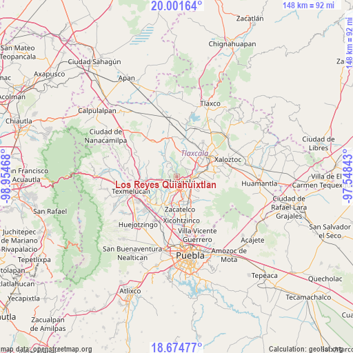
| Upper-left | 20.00164°, | -98.95468° |
| Center: | 19.33955°, | -98.25155° |
| Lower-right: | 18.67477°, | -97.54843° |
| Map W x H: | 147.5×147.5 km | = 91.7×91.7mi |
| max Lat: | 32.7° ⇑57.9% North |
| Los Reyes Quiahuixtlan: | 19.33955° |
| min Lat: | ⇓42.1% South 14.53588° |
| min Long | Los Reyes Quiah | max Long |
| -117.105° | -98.25155° | -86.73105° |
| W 60.5%⇐ | ⇒39.5% E |
Elevation
Elevation of Los Reyes Quiahuixtlan is 2285 m = 7497 ft, and this is 1031.3 m = 3384 ft above average elevation for this country.
| Max E: |
3497 m = 11473 ft | 13.9% |
| Los Reyes Quiahuixtlan | 2285 m 7497 ft | |
| Avg. | 1253.7 m = 4113 ft | |
Min E: |
-1 m = -3 ft | 86.1% |
See also: Mexico elevation on elevation.city.
Geographical zone
Los Reyes Quiahuixtlan is located in North Torrid zone (between Equator and Tropic of Cancer). Distance of this Northern Tropic circle is 455.6 km =283.1 mi to North.| Distance of | km | miles | from Los Reyes Quiahuixtlan |
|---|---|---|---|
| North Pole | 7856.7 | 4881.9 | to North |
| Arctic Circle | 5250.8 | 3262.7 | to North |
| Tropic Cancer | 455.6 | 283.1 | to North |
| Equator | 2150.4 | 1336.2 | to South |


Nearby cities:
15 places around Los Reyes Quiahuixtlan: (largest is in red/bold)
• Acxotla del Río
2.3 km =1.4 mi,  139°
139°
• Fraccionamiento la Virgen
3 km =1.9 mi,  231°
231°
• La Candelaria Teotlalpan
2.8 km =1.7 mi,  104°
104°
• La Trinidad Chimalpa
1.3 km =0.8 mi,  149°
149°
• Panotla
3.2 km =2 mi,  216°
216°
• San Ambrosio Texantla
1.9 km =1.2 mi,  342°
342°
• San Buenaventura Atempan
3.4 km =2.1 mi,  114°
114°
• San Esteban Tizatlán
4 km =2.5 mi,  90°
90°
• San Francisco Temetzontla
4.1 km =2.5 mi,  287°
287°
• San Hipólito Chimalpa
2.2 km =1.4 mi,  175°
175°
• San Miguel Tlamahuco
2.1 km =1.3 mi, 144°
• Santiago Tepeticpac
2.6 km =1.6 mi, 101°
• Totolac
1.7 km =1.1 mi,  204°
204°
• Unidad Habitacional II
3.5 km =2.2 mi,  241°
241°
• Zaragoza
2.7 km =1.7 mi,  209°
209°
Sources, notices
• [Note1] Compared only with cities in Mexico existing in our database
• [Src1] Map data: © OpenStreetMap contributors (CC-BY-SA)
• [Src2] Other city data from geonames.org with taken over terms of usage.
• [Src3] Geographical zone / Annual Mean Temperature by Robert A. Rohde @ Wikipedia
