San Miguel Tlamahuco geodata
San Miguel Tlamahuco (Tlaxcala) is a populated place; located in Mexico in America/Mexico_City (GMT-6) time zone. With population of 1,010 people, there are 8622 cities with bigger population in this country. Compared to other cities in Mexico, 58.3% of cities are located further ↑North; 60.6% of cities are located further ←West and 85.4% of cities have lower elevation than San Miguel Tlamahuco. Note1
Current local time in San Miguel Tlamahuco:
03:40 AM, WednesdayDifference from your time zone: hours


San Miguel Tlamahuco GPS coordinates[2]
19° 19' 27.012" North, 98° 14' 22.992" West
| Map corner | latitude | longitude |
|---|---|---|
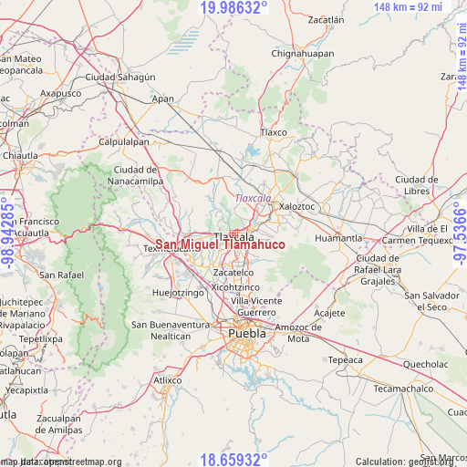
| Upper-left | 19.98632°, | -98.94285° |
| Center: | 19.32417°, | -98.23972° |
| Lower-right: | 18.65932°, | -97.5366° |
| Map W x H: | 147.5×147.6 km | = 91.7×91.7mi |
| max Lat: | 32.7° ⇑58.3% North |
| San Miguel Tlamahuco: | 19.32417° |
| min Lat: | ⇓41.7% South 14.53588° |
| min Long | San Miguel Tlam | max Long |
| -117.105° | -98.23972° | -86.73105° |
| W 60.6%⇐ | ⇒39.4% E |
Elevation
Elevation of San Miguel Tlamahuco is 2266 m = 7434 ft, and this is 1012.3 m = 3321 ft above average elevation for this country.
| Max E: |
3497 m = 11473 ft | 14.6% |
| San Miguel Tlamahuco | 2266 m 7434 ft | |
| Avg. | 1253.7 m = 4113 ft | |
Min E: |
-1 m = -3 ft | 85.4% |
See also: Mexico elevation on elevation.city.
Geographical zone
San Miguel Tlamahuco is located in North Torrid zone (between Equator and Tropic of Cancer). Distance of this Northern Tropic circle is 457.3 km =284.2 mi to North.| Distance of | km | miles | from San Miguel Tlamahuco |
|---|---|---|---|
| North Pole | 7858.4 | 4883 | to North |
| Arctic Circle | 5252.5 | 3263.8 | to North |
| Tropic Cancer | 457.3 | 284.2 | to North |
| Equator | 2148.6 | 1335.1 | to South |


Nearby cities:
15 places around San Miguel Tlamahuco: (largest is in red/bold)
• Acxotla del Río
0.2 km =0.1 mi,  90°
90°
• Fraccionamiento la Virgen
3.6 km =2.2 mi,  268°
268°
• La Candelaria Teotlalpan
1.8 km =1.1 mi,  56°
56°
• La Trinidad Chimalpa
0.8 km =0.5 mi,  315°
315°
• Los Reyes Quiahuixtlan
2.1 km =1.3 mi, 324°
• Panotla
3.3 km =2.1 mi,  254°
254°
• San Ambrosio Texantla
3.9 km =2.4 mi,  332°
332°
• San Buenaventura Atempan
1.9 km =1.2 mi,  81°
81°
• San Esteban Tizatlán
3.2 km =2 mi, 58°
• San Hipólito Chimalpa
1.2 km =0.7 mi, 245°
• Santa María Ixtulco
3.3 km =2.1 mi, 87°
• Santiago Tepeticpac
1.8 km =1.1 mi,  48°
48°
• Tlatempan
3.9 km =2.4 mi, 77°
• Totolac
2 km =1.2 mi,  275°
275°
• Zaragoza
2.6 km =1.6 mi,  256°
256°
Sources, notices
• [Note1] Compared only with cities in Mexico existing in our database
• [Src1] Map data: © OpenStreetMap contributors (CC-BY-SA)
• [Src2] Other city data from geonames.org with taken over terms of usage.
• [Src3] Geographical zone / Annual Mean Temperature by Robert A. Rohde @ Wikipedia
