San Andrés Ahuashuatepec geodata
San Andrés Ahuashuatepec (Tlaxcala) is a populated place; located in Mexico in America/Mexico_City (GMT-6) time zone. With population of 10,114 people, there are 940 cities with bigger population in this country. Compared to other cities in Mexico, 56.8% of cities are located further ↑North; 62.4% of cities are located further ←West and 91.5% of cities have lower elevation than San Andrés Ahuashuatepec. Note1
Current local time in San Andrés Ahuashuatepec:
10:37 PM, TuesdayDifference from your time zone: hours


San Andrés Ahuashuatepec GPS coordinates[2]
19° 22' 41.916" North, 98° 6' 23.544" West
| Map corner | latitude | longitude |
|---|---|---|
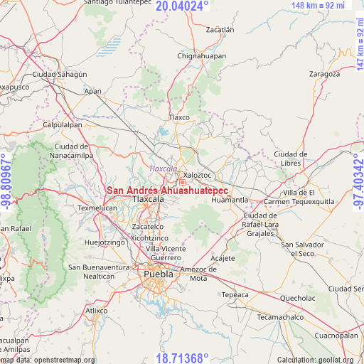
| Upper-left | 20.04024°, | -98.80967° |
| Center: | 19.37831°, | -98.10654° |
| Lower-right: | 18.71368°, | -97.40342° |
| Map W x H: | 147.5×147.5 km | = 91.7×91.7mi |
| max Lat: | 32.7° ⇑56.8% North |
| San Andrés Ahuashuatepec: | 19.37831° |
| min Lat: | ⇓43.2% South 14.53588° |
| min Long | San Andrés Ahu | max Long |
| -117.105° | -98.10654° | -86.73105° |
| W 62.4%⇐ | ⇒37.6% E |
Elevation
Elevation of San Andrés Ahuashuatepec is 2459 m = 8068 ft, and this is 1205.3 m = 3954 ft above average elevation for this country.
| Max E: |
3497 m = 11473 ft | 8.5% |
| San Andrés Ahuashuatepec | 2459 m 8068 ft | |
| Avg. | 1253.7 m = 4113 ft | |
Min E: |
-1 m = -3 ft | 91.5% |
See also: Mexico elevation on elevation.city.
Geographical zone
San Andrés Ahuashuatepec is located in North Torrid zone (between Equator and Tropic of Cancer). Distance of this Northern Tropic circle is 451.3 km =280.4 mi to North.| Distance of | km | miles | from San Andrés Ahuashuatepec |
|---|---|---|---|
| North Pole | 7852.4 | 4879.3 | to North |
| Arctic Circle | 5246.5 | 3260 | to North |
| Tropic Cancer | 451.3 | 280.4 | to North |
| Equator | 2154.7 | 1338.9 | to South |


Nearby cities:
15 places around San Andrés Ahuashuatepec: (largest is in red/bold)
• Apizaco
5.5 km =3.4 mi,  315°
315°
• Colonia San Isidro
3.8 km =2.4 mi,  349°
349°
• Cuaxomulco
3 km =1.9 mi,  160°
160°
• Jesús Huitznahuac
4.6 km =2.9 mi,  209°
209°
• San José Tepoxtla
5.3 km =3.3 mi,  274°
274°
• San Juan Quetzalcoapan
3.7 km =2.3 mi,  88°
88°
• San Lorenzo Xaltelulco
4.2 km =2.6 mi,  179°
179°
• San Luis Apizaquito
5.3 km =3.3 mi, 348°
• San Miguel Buenavista
4.3 km =2.7 mi,  128°
128°
• San Miguel Contla
3.3 km =2.1 mi,  234°
234°
• Santa Anita Huiloac
4 km =2.5 mi,  286°
286°
• Santa Cruz Tlaxcala
5.3 km =3.3 mi,  240°
240°
• Santa María Texcalac
5.4 km =3.4 mi,  22°
22°
• Tzompantepec
1.7 km =1.1 mi,  98°
98°
• Xaltianquisco
2.7 km =1.7 mi,  109°
109°
Sources, notices
• [Note1] Compared only with cities in Mexico existing in our database
• [Src1] Map data: © OpenStreetMap contributors (CC-BY-SA)
• [Src2] Other city data from geonames.org with taken over terms of usage.
• [Src3] Geographical zone / Annual Mean Temperature by Robert A. Rohde @ Wikipedia
