Xaltianquisco geodata
Xaltianquisco (Tlaxcala) is a populated place; located in Mexico in America/Mexico_City (GMT-6) time zone. With population of 884 people, there are 9870 cities with bigger population in this country. Compared to other cities in Mexico, 57.1% of cities are located further ↑North; 62.6% of cities are located further ←West and 92.4% of cities have lower elevation than Xaltianquisco. Note1


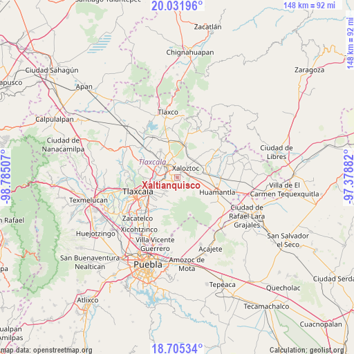
Xaltianquisco GPS coordinates[2]
19° 22' 12" North, 98° 4' 54.984" West
| Map corner | latitude | longitude |
|---|---|---|
| Upper-left | 20.03196°, | -98.78507° |
| Center: | 19.37°, | -98.08194° |
| Lower-right: | 18.70534°, | -97.37882° |
| Map W x H: | 147.5×147.5 km | = 91.7×91.7mi |
| max Lat: | 32.7° ⇑57.1% North |
| Xaltianquisco: | 19.37° |
| min Lat: | ⇓42.9% South 14.53588° |
| min Long | Xaltianquisco | max Long |
| -117.105° | -98.08194° | -86.73105° |
| W 62.6%⇐ | ⇒37.4% E |
Elevation
Elevation of Xaltianquisco is 2501 m = 8205 ft, and this is 1247.3 m = 4092 ft above average elevation for this country.
| Max E: |
3497 m = 11473 ft | 7.6% |
| Xaltianquisco | 2501 m 8205 ft | |
| Avg. | 1253.7 m = 4113 ft | |
Min E: |
-1 m = -3 ft | 92.4% |
See also: Mexico elevation on elevation.city.
Geographical zone
Xaltianquisco is located in North Torrid zone (between Equator and Tropic of Cancer). Distance of this Northern Tropic circle is 452.2 km =281 mi to North.| Distance of | km | miles | from Xaltianquisco |
|---|---|---|---|
| North Pole | 7853.3 | 4879.8 | to North |
| Arctic Circle | 5247.4 | 3260.6 | to North |
| Tropic Cancer | 452.2 | 281 | to North |
| Equator | 2153.7 | 1338.2 | to South |


Nearby cities:
15 places around Xaltianquisco: (largest is in red/bold)
• Colonia San Isidro
5.7 km =3.5 mi,  325°
325°
• Colonia Venustiano Carranza
4.2 km =2.6 mi,  36°
36°
• Cuaxomulco
2.5 km =1.6 mi,  218°
218°
• Guadalupe Tlachco
5.5 km =3.4 mi,  212°
212°
• Jesús Huitznahuac
5.7 km =3.5 mi,  237°
237°
• San Andrés Ahuashuatepec
2.7 km =1.7 mi,  289°
289°
• San José Teacalco
4.2 km =2.6 mi,  154°
154°
• San Juan Quetzalcoapan
1.5 km =0.9 mi,  47°
47°
• San Lorenzo Xaltelulco
4.1 km =2.5 mi, 217°
• San Miguel Buenavista
1.9 km =1.2 mi,  155°
155°
• San Miguel Contla
5.4 km =3.4 mi,  259°
259°
• San Pedro Tlacotepec
4.7 km =2.9 mi, 52°
• Santa Cruz Zacatzontetla
5.8 km =3.6 mi,  57°
57°
• Tzompantepec
1.1 km =0.7 mi,  308°
308°
• Xaloztoc
5.6 km =3.5 mi, 41°
Sources, notices
• [Note1] Compared only with cities in Mexico existing in our database
• [Src1] Map data: © OpenStreetMap contributors (CC-BY-SA)
• [Src2] Other city data from geonames.org with taken over terms of usage.
• [Src3] Geographical zone / Annual Mean Temperature by Robert A. Rohde @ Wikipedia
