Tetlatlahuca geodata
Tetlatlahuca (Tlaxcala) is a seat of a second-order administrative division; located in Mexico in America/Mexico_City (GMT-6) time zone. With population of 4,218 people, there are 2176 cities with bigger population in this country. Compared to other cities in Mexico, 60.3% of cities are located further ↑North; 59.9% of cities are located further ←West and 82.6% of cities have lower elevation than Tetlatlahuca. Note1


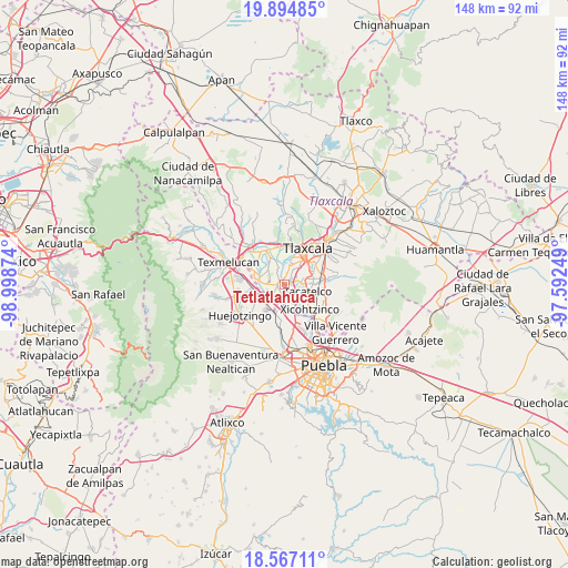
Tetlatlahuca GPS coordinates[2]
19° 13' 56.352" North, 98° 17' 44.196" West
| Map corner | latitude | longitude |
|---|---|---|
| Upper-left | 19.89485°, | -98.99874° |
| Center: | 19.23232°, | -98.29561° |
| Lower-right: | 18.56711°, | -97.59249° |
| Map W x H: | 147.6×147.6 km | = 91.7×91.7mi |
| max Lat: | 32.7° ⇑60.3% North |
| Tetlatlahuca: | 19.23232° |
| min Lat: | ⇓39.7% South 14.53588° |
| min Long | Tetlatlahuca | max Long |
| -117.105° | -98.29561° | -86.73105° |
| W 59.9%⇐ | ⇒40.1% E |
Elevation
Elevation of Tetlatlahuca is 2205 m = 7234 ft, and this is 951.3 m = 3121 ft above average elevation for this country.
| Max E: |
3497 m = 11473 ft | 17.4% |
| Tetlatlahuca | 2205 m 7234 ft | |
| Avg. | 1253.7 m = 4113 ft | |
Min E: |
-1 m = -3 ft | 82.6% |
See also: Mexico elevation on elevation.city.
Geographical zone
Tetlatlahuca is located in North Torrid zone (between Equator and Tropic of Cancer). Distance of this Northern Tropic circle is 467.5 km =290.5 mi to North.| Distance of | km | miles | from Tetlatlahuca |
|---|---|---|---|
| North Pole | 7868.6 | 4889.3 | to North |
| Arctic Circle | 5262.7 | 3270.1 | to North |
| Tropic Cancer | 467.5 | 290.5 | to North |
| Equator | 2138.4 | 1328.7 | to South |


Nearby cities:
15 places around Tetlatlahuca: (largest is in red/bold)
• Guadalupe Victoria
4.1 km =2.5 mi,  270°
270°
• Jesús Tepactepec
2 km =1.2 mi,  259°
259°
• Natívitas
2 km =1.2 mi, 273°
• San Bartolomé Tenango
2.3 km =1.4 mi,  10°
10°
• San Damián Texoloc
5.2 km =3.2 mi, 11°
• San Francisco Tenexyecac
5.5 km =3.4 mi,  337°
337°
• San Jerónimo Zacualpan
3.7 km =2.3 mi,  75°
75°
• San Juan Huactzinco
4.5 km =2.8 mi,  88°
88°
• San Lorenzo Axocomanitla
5 km =3.1 mi,  100°
100°
• San Miguel del Milagro
4.1 km =2.5 mi,  283°
283°
• Santa Ana Portales
3.6 km =2.2 mi,  190°
190°
• Santa Apolonia Teacalco
2 km =1.2 mi,  300°
300°
• Santa Cruz Aquiahuac
1.6 km =1 mi,  60°
60°
• Santiago Michac
4.8 km =3 mi,  253°
253°
• Santo Tomás la Concordia
2.5 km =1.6 mi, 262°
Sources, notices
• [Note1] Compared only with cities in Mexico existing in our database
• [Src1] Map data: © OpenStreetMap contributors (CC-BY-SA)
• [Src2] Other city data from geonames.org with taken over terms of usage.
• [Src3] Geographical zone / Annual Mean Temperature by Robert A. Rohde @ Wikipedia
