San Miguel del Milagro geodata
San Miguel del Milagro (Puebla) is a populated place; located in Mexico in America/Mexico_City (GMT-6) time zone. With population of 1,117 people, there are 7781 cities with bigger population in this country. Compared to other cities in Mexico, 60.1% of cities are located further ↑North; 59.5% of cities are located further ←West and 86.6% of cities have lower elevation than San Miguel del Milagro. Note1
Current local time in San Miguel del Milagro:
06:48 AM, WednesdayDifference from your time zone: hours


San Miguel del Milagro GPS coordinates[2]
19° 14' 28.428" North, 98° 20' 0.672" West
| Map corner | latitude | longitude |
|---|---|---|
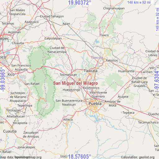
| Upper-left | 19.90372°, | -99.03665° |
| Center: | 19.24123°, | -98.33352° |
| Lower-right: | 18.57605°, | -97.6304° |
| Map W x H: | 147.6×147.6 km | = 91.7×91.7mi |
| max Lat: | 32.7° ⇑60.1% North |
| San Miguel del Milagro: | 19.24123° |
| min Lat: | ⇓39.9% South 14.53588° |
| min Long | San Miguel del | max Long |
| -117.105° | -98.33352° | -86.73105° |
| W 59.5%⇐ | ⇒40.5% E |
Elevation
Elevation of San Miguel del Milagro is 2299 m = 7543 ft, and this is 1045.3 m = 3429 ft above average elevation for this country.
| Max E: |
3497 m = 11473 ft | 13.4% |
| San Miguel del Milagro | 2299 m 7543 ft | |
| Avg. | 1253.7 m = 4113 ft | |
Min E: |
-1 m = -3 ft | 86.6% |
See also: Mexico elevation on elevation.city.
Geographical zone
San Miguel del Milagro is located in North Torrid zone (between Equator and Tropic of Cancer). Distance of this Northern Tropic circle is 466.5 km =289.9 mi to North.| Distance of | km | miles | from San Miguel del Milagro |
|---|---|---|---|
| North Pole | 7867.6 | 4888.7 | to North |
| Arctic Circle | 5261.7 | 3269.5 | to North |
| Tropic Cancer | 466.5 | 289.9 | to North |
| Equator | 2139.4 | 1329.4 | to South |


Nearby cities:
15 places around San Miguel del Milagro: (largest is in red/bold)
• Guadalupe Victoria
1 km =0.6 mi,  187°
187°
• Jesús Tepactepec
2.4 km =1.5 mi,  123°
123°
• Natívitas
2.2 km =1.4 mi,  113°
113°
• San Bartolomé Tenango
4.6 km =2.9 mi,  74°
74°
• San Francisco Tenexyecac
4.5 km =2.8 mi,  25°
25°
• San José Atoyatenco
2.5 km =1.6 mi,  295°
295°
• San Miguel Xochitecatitla
2.2 km =1.4 mi,  262°
262°
• San Rafael Tenanyecac
4 km =2.5 mi,  280°
280°
• Santa Ana Portales
5.6 km =3.5 mi,  143°
143°
• Santa Apolonia Teacalco
2.3 km =1.4 mi,  89°
89°
• Santa Cruz Aquiahuac
5.4 km =3.4 mi, 92°
• Santiago Michac
2.5 km =1.6 mi, 194°
• Santo Tomás la Concordia
2 km =1.2 mi,  132°
132°
• Tepetitla
5.2 km =3.2 mi, 300°
• Tetlatlahuca
4.1 km =2.5 mi,  103°
103°
Sources, notices
• [Note1] Compared only with cities in Mexico existing in our database
• [Src1] Map data: © OpenStreetMap contributors (CC-BY-SA)
• [Src2] Other city data from geonames.org with taken over terms of usage.
• [Src3] Geographical zone / Annual Mean Temperature by Robert A. Rohde @ Wikipedia
