La Palma geodata
La Palma (Chiapas) is a populated place; located in Mexico in America/Mexico_City (GMT-6) time zone. With population of 630 people, there are 13737 cities with bigger population in this country. Compared to other cities in Mexico, 94.2% of cities are located further ↑North; 88% of cities are located further ←West and 62.4% of cities have higher elevation than La Palma. Note1


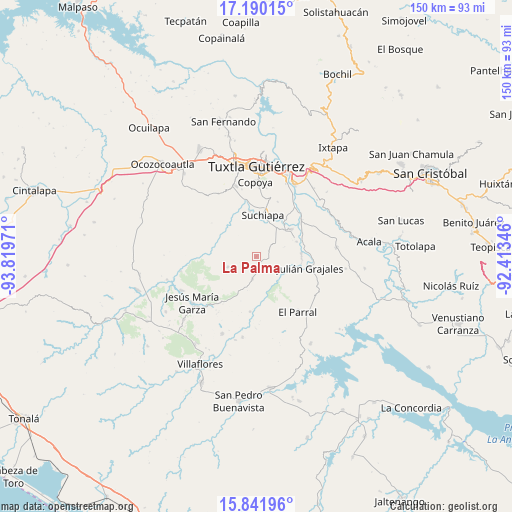
La Palma GPS coordinates[2]
16° 31' 2.028" North, 93° 6' 59.688" West
| Map corner | latitude | longitude |
|---|---|---|
| Upper-left | 17.19015°, | -93.81971° |
| Center: | 16.51723°, | -93.11658° |
| Lower-right: | 15.84196°, | -92.41346° |
| Map W x H: | 149.9×149.9 km | = 93.1×93.1mi |
| max Lat: | 32.7° ⇑94.2% North |
| La Palma: | 16.51723° |
| min Lat: | ⇓5.8% South 14.53588° |
| min Long | La Palma | max Long |
| -117.105° | -93.11658° | -86.73105° |
| W 88%⇐ | ⇒12% E |
Elevation
Elevation of La Palma is 857 m = 2812 ft, and this is 396.7 m = 1302 ft below average elevation for this country.
| Max E: |
3497 m = 11473 ft | 62.4% |
| Avg. | 1253.7 m = 4113 ft | |
| La Palma | 857 m = 2812 ft | |
Min E: |
-1 m = -3 ft | 37.6% |
See also: Mexico elevation on elevation.city.
Geographical zone
La Palma is located in North Torrid zone (between Equator and Tropic of Cancer). Distance of this Northern Tropic circle is 769.4 km =478.1 mi to North.| Distance of | km | miles | from La Palma |
|---|---|---|---|
| North Pole | 8170.5 | 5076.9 | to North |
| Arctic Circle | 5564.6 | 3457.7 | to North |
| Tropic Cancer | 769.4 | 478.1 | to North |
| Equator | 1836.5 | 1141.1 | to South |


Nearby cities:
15 places around La Palma: (largest is in red/bold)
• América Libre
17.1 km =10.6 mi,  50°
50°
• Distrito Federal
12.5 km =7.8 mi, 49°
• El Portillo
16.7 km =10.4 mi,  246°
246°
• Francisco Sarabia
12.6 km =7.8 mi,  69°
69°
• Galecio Narcia
12.9 km =8 mi, 52°
• Ignacio Allende
13.3 km =8.3 mi,  86°
86°
• Ignacio Zaragoza
16.2 km =10.1 mi,  186°
186°
• Julián Grajales
16.1 km =10 mi,  102°
102°
• Narciso Mendoza
15.3 km =9.5 mi,  62°
62°
• Nicolás Bravo
13.3 km =8.3 mi, 93°
• Pacú
13.3 km =8.3 mi,  351°
351°
• Palenque de los Pinos
4 km =2.5 mi,  160°
160°
• Ribera la Unión (Castaño)
16 km =9.9 mi, 54°
• Roblada Grande
8.9 km =5.5 mi, 249°
• Suchiapa
12.2 km =7.6 mi,  7°
7°
Sources, notices
• [Note1] Compared only with cities in Mexico existing in our database
• [Src1] Map data: © OpenStreetMap contributors (CC-BY-SA)
• [Src2] Other city data from geonames.org with taken over terms of usage.
• [Src3] Geographical zone / Annual Mean Temperature by Robert A. Rohde @ Wikipedia
