Ignacio Allende geodata
Ignacio Allende (Chiapas) is a populated place; located in Mexico in America/Mexico_City (GMT-6) time zone. With population of 1,396 people, there are 6199 cities with bigger population in this country. Compared to other cities in Mexico, 94.1% of cities are located further ↑North; 88.6% of cities are located further ←West and 69.5% of cities have higher elevation than Ignacio Allende. Note1


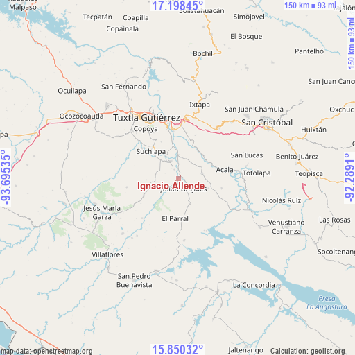
Ignacio Allende GPS coordinates[2]
16° 31' 32.016" North, 92° 59' 31.992" West
| Map corner | latitude | longitude |
|---|---|---|
| Upper-left | 17.19845°, | -93.69535° |
| Center: | 16.52556°, | -92.99222° |
| Lower-right: | 15.85032°, | -92.2891° |
| Map W x H: | 149.9×149.9 km | = 93.1×93.1mi |
| max Lat: | 32.7° ⇑94.1% North |
| Ignacio Allende: | 16.52556° |
| min Lat: | ⇓5.9% South 14.53588° |
| min Long | Ignacio Allende | max Long |
| -117.105° | -92.99222° | -86.73105° |
| W 88.6%⇐ | ⇒11.4% E |
Elevation
Elevation of Ignacio Allende is 443 m = 1453 ft, and this is 810.7 m = 2660 ft below average elevation for this country.
| Max E: |
3497 m = 11473 ft | 69.5% |
| Avg. | 1253.7 m = 4113 ft | |
| Ignacio Allende | 443 m = 1453 ft | |
Min E: |
-1 m = -3 ft | 30.5% |
See also: Mexico elevation on elevation.city.
Geographical zone
Ignacio Allende is located in North Torrid zone (between Equator and Tropic of Cancer). Distance of this Northern Tropic circle is 768.4 km =477.5 mi to North.| Distance of | km | miles | from Ignacio Allende |
|---|---|---|---|
| North Pole | 8169.6 | 5076.4 | to North |
| Arctic Circle | 5563.7 | 3457.1 | to North |
| Tropic Cancer | 768.4 | 477.5 | to North |
| Equator | 1837.5 | 1141.8 | to South |


Nearby cities:
15 places around Ignacio Allende: (largest is in red/bold)
• Adolfo López Mateos
13.9 km =8.6 mi,  48°
48°
• Amatal
12.4 km =7.7 mi,  357°
357°
• América Libre
9.9 km =6.2 mi,  0°
0°
• Distrito Federal
8.1 km =5 mi,  332°
332°
• Francisco Sarabia
3.7 km =2.3 mi,  337°
337°
• Galecio Narcia
7.6 km =4.7 mi, 336°
• Julián Grajales
4.9 km =3 mi,  150°
150°
• La Palma
13.3 km =8.3 mi,  266°
266°
• Narciso Mendoza
6.1 km =3.8 mi, 3°
• Nicolás Bravo
1.7 km =1.1 mi,  180°
180°
• Nueva Palestina (Nandayacuti)
15.4 km =9.6 mi,  7°
7°
• Nuevo Vicente Guerrero (El Chichonal)
13.6 km =8.5 mi,  109°
109°
• Palenque de los Pinos
12.8 km =8 mi,  248°
248°
• Ribera la Unión (Castaño)
8.4 km =5.2 mi, 358°
• Salvador Urbina
12.3 km =7.6 mi,  354°
354°
Sources, notices
• [Note1] Compared only with cities in Mexico existing in our database
• [Src1] Map data: © OpenStreetMap contributors (CC-BY-SA)
• [Src2] Other city data from geonames.org with taken over terms of usage.
• [Src3] Geographical zone / Annual Mean Temperature by Robert A. Rohde @ Wikipedia
