Patihuitz geodata
Patihuitz (Chiapas) is a populated place; located in Mexico in America/Mexico_City (GMT-6) time zone. With population of 863 people, there are 10137 cities with bigger population in this country. Compared to other cities in Mexico, 92.4% of cities are located further ↑North; 95.9% of cities are located further ←West and 61.1% of cities have higher elevation than Patihuitz. Note1


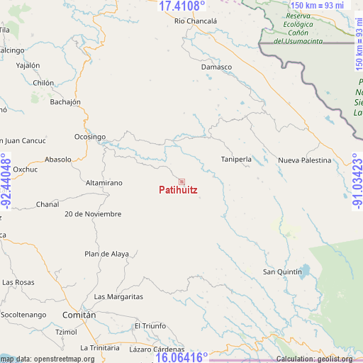
Patihuitz GPS coordinates[2]
16° 44' 19.212" North, 91° 44' 14.46" West
| Map corner | latitude | longitude |
|---|---|---|
| Upper-left | 17.4108°, | -92.44048° |
| Center: | 16.73867°, | -91.73735° |
| Lower-right: | 16.06416°, | -91.03423° |
| Map W x H: | 149.7×149.7 km | = 93×93mi |
| max Lat: | 32.7° ⇑92.4% North |
| Patihuitz: | 16.73867° |
| min Lat: | ⇓7.6% South 14.53588° |
| min Long | Patihuitz | max Long |
| -117.105° | -91.73735° | -86.73105° |
| W 95.9%⇐ | ⇒4.1% E |
Elevation
Elevation of Patihuitz is 929 m = 3048 ft, and this is 324.7 m = 1065 ft below average elevation for this country.
| Max E: |
3497 m = 11473 ft | 61.1% |
| Avg. | 1253.7 m = 4113 ft | |
| Patihuitz | 929 m = 3048 ft | |
Min E: |
-1 m = -3 ft | 38.9% |
See also: Mexico elevation on elevation.city.
Geographical zone
Patihuitz is located in North Torrid zone (between Equator and Tropic of Cancer). Distance of this Northern Tropic circle is 744.8 km =462.8 mi to North.| Distance of | km | miles | from Patihuitz |
|---|---|---|---|
| North Pole | 8145.9 | 5061.6 | to North |
| Arctic Circle | 5540 | 3442.4 | to North |
| Tropic Cancer | 744.8 | 462.8 | to North |
| Equator | 1861.2 | 1156.5 | to South |


Nearby cities:
15 places around Patihuitz: (largest is in red/bold)
• Ach Lum Monte Líbano
21.4 km =13.3 mi,  33°
33°
• Belisario Domínguez
10.3 km =6.4 mi,  183°
183°
• Carmen Rusia
21 km =13 mi,  210°
210°
• El Prado Pacayal
9.9 km =6.2 mi,  131°
131°
• El Triunfo
7.4 km =4.6 mi,  196°
196°
• Las Tazas
13.2 km =8.2 mi,  81°
81°
• Luis Espinoza
20.8 km =12.9 mi,  143°
143°
• Plácido Flores
20.9 km =13 mi, 31°
• San Antonio las Delicias (Pamala)
21.9 km =13.6 mi,  317°
317°
• San Francisco
15.1 km =9.4 mi, 179°
• San Juan Rómulo Calzada
17.9 km =11.1 mi, 131°
• San Luis Potosí
17.9 km =11.1 mi,  147°
147°
• San Marcos
12.4 km =7.7 mi,  171°
171°
• San Miguel
13.7 km =8.5 mi,  298°
298°
• Santo Tomás
19.7 km =12.2 mi,  94°
94°
Sources, notices
• [Note1] Compared only with cities in Mexico existing in our database
• [Src1] Map data: © OpenStreetMap contributors (CC-BY-SA)
• [Src2] Other city data from geonames.org with taken over terms of usage.
• [Src3] Geographical zone / Annual Mean Temperature by Robert A. Rohde @ Wikipedia
