San Miguel geodata
San Miguel (Chiapas) is a populated place; located in Mexico in America/Mexico_City (GMT-6) time zone. With population of 729 people, there are 11976 cities with bigger population in this country. Compared to other cities in Mexico, 91.8% of cities are located further ↑North; 95.7% of cities are located further ←West and 62.2% of cities have higher elevation than San Miguel. Note1


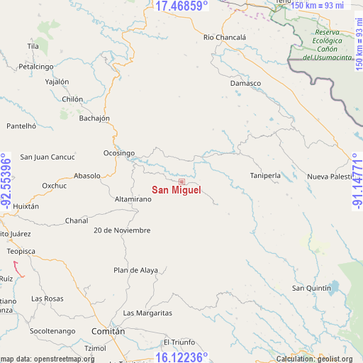
San Miguel GPS coordinates[2]
16° 47' 48.012" North, 91° 51' 2.988" West
| Map corner | latitude | longitude |
|---|---|---|
| Upper-left | 17.46859°, | -92.55396° |
| Center: | 16.79667°, | -91.85083° |
| Lower-right: | 16.12236°, | -91.14771° |
| Map W x H: | 149.7×149.7 km | = 93×93mi |
| max Lat: | 32.7° ⇑91.8% North |
| San Miguel: | 16.79667° |
| min Lat: | ⇓8.2% South 14.53588° |
| min Long | San Miguel | max Long |
| -117.105° | -91.85083° | -86.73105° |
| W 95.7%⇐ | ⇒4.3% E |
Elevation
Elevation of San Miguel is 873 m = 2864 ft, and this is 380.7 m = 1249 ft below average elevation for this country.
| Max E: |
3497 m = 11473 ft | 62.2% |
| Avg. | 1253.7 m = 4113 ft | |
| San Miguel | 873 m = 2864 ft | |
Min E: |
-1 m = -3 ft | 37.8% |
See also: Mexico elevation on elevation.city.
Geographical zone
San Miguel is located in North Torrid zone (between Equator and Tropic of Cancer). Distance of this Northern Tropic circle is 738.3 km =458.8 mi to North.| Distance of | km | miles | from San Miguel |
|---|---|---|---|
| North Pole | 8139.4 | 5057.6 | to North |
| Arctic Circle | 5533.6 | 3438.4 | to North |
| Tropic Cancer | 738.3 | 458.8 | to North |
| Equator | 1867.6 | 1160.5 | to South |


Nearby cities:
15 places around San Miguel: (largest is in red/bold)
• Altamirano
21.1 km =13.1 mi,  250°
250°
• Belisario Domínguez
20.3 km =12.6 mi,  145°
145°
• El Prado Pacayal
23.4 km =14.5 mi,  123°
123°
• El Triunfo
16.9 km =10.5 mi,  143°
143°
• Joaquín Miguel Gutiérrez
19.6 km =12.2 mi,  276°
276°
• La Laguna
15.5 km =9.6 mi,  222°
222°
• La Reforma
18.6 km =11.6 mi,  343°
343°
• Morelia (Victórico Rodolfo Grajales)
14.9 km =9.3 mi,  236°
236°
• Nazaret
21.3 km =13.2 mi, 341°
• Nuevo Jerusalén
21.7 km =13.5 mi,  300°
300°
• Nuevo San Carlos
16.9 km =10.5 mi,  227°
227°
• Patihuitz
13.7 km =8.5 mi, 118°
• San Antonio las Delicias (Pamala)
10.2 km =6.3 mi,  345°
345°
• San Marcos
23.4 km =14.5 mi, 143°
• San Salvador
19.7 km =12.2 mi, 351°
Sources, notices
• [Note1] Compared only with cities in Mexico existing in our database
• [Src1] Map data: © OpenStreetMap contributors (CC-BY-SA)
• [Src2] Other city data from geonames.org with taken over terms of usage.
• [Src3] Geographical zone / Annual Mean Temperature by Robert A. Rohde @ Wikipedia
