Santo Tomás geodata
Santo Tomás (Chiapas) is a populated place; located in Mexico in America/Mexico_City (GMT-6) time zone. With population of 663 people, there are 13102 cities with bigger population in this country. Compared to other cities in Mexico, 92.6% of cities are located further ↑North; 96.2% of cities are located further ←West and 65.1% of cities have higher elevation than Santo Tomás. Note1


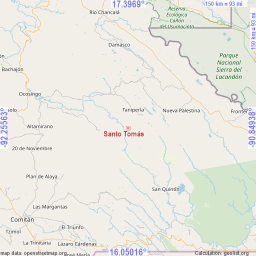
Santo Tomás GPS coordinates[2]
16° 43' 28.992" North, 91° 33' 9" West
| Map corner | latitude | longitude |
|---|---|---|
| Upper-left | 17.3969°, | -92.25563° |
| Center: | 16.72472°, | -91.5525° |
| Lower-right: | 16.05016°, | -90.84938° |
| Map W x H: | 149.7×149.7 km | = 93×93mi |
| max Lat: | 32.7° ⇑92.6% North |
| Santo Tomás: | 16.72472° |
| min Lat: | ⇓7.4% South 14.53588° |
| min Long | Santo Tomás | max Long |
| -117.105° | -91.5525° | -86.73105° |
| W 96.2%⇐ | ⇒3.8% E |
Elevation
Elevation of Santo Tomás is 681 m = 2234 ft, and this is 572.7 m = 1879 ft below average elevation for this country.
| Max E: |
3497 m = 11473 ft | 65.1% |
| Avg. | 1253.7 m = 4113 ft | |
| Santo Tomás | 681 m = 2234 ft | |
Min E: |
-1 m = -3 ft | 34.9% |
See also: Mexico elevation on elevation.city.
Geographical zone
Santo Tomás is located in North Torrid zone (between Equator and Tropic of Cancer). Distance of this Northern Tropic circle is 746.3 km =463.7 mi to North.| Distance of | km | miles | from Santo Tomás |
|---|---|---|---|
| North Pole | 8147.4 | 5062.6 | to North |
| Arctic Circle | 5541.6 | 3443.4 | to North |
| Tropic Cancer | 746.3 | 463.7 | to North |
| Equator | 1859.6 | 1155.5 | to South |


Nearby cities:
15 places around Santo Tomás: (largest is in red/bold)
• Agua Azul
10.4 km =6.5 mi,  16°
16°
• El Censo
15.4 km =9.6 mi,  357°
357°
• El Prado Pacayal
13.3 km =8.3 mi,  247°
247°
• El Zapotal
12.1 km =7.5 mi,  76°
76°
• Las Tazas
7.6 km =4.7 mi,  298°
298°
• Luis Espinoza
16.9 km =10.5 mi,  206°
206°
• Patihuitz
19.7 km =12.2 mi,  274°
274°
• Perla de Acapulco
11.2 km =7 mi,  45°
45°
• San Caralampio
13.6 km =8.5 mi, 83°
• San José
16.6 km =10.3 mi,  95°
95°
• San Juan Rómulo Calzada
12.1 km =7.5 mi, 211°
• San Luis Potosí
16.7 km =10.4 mi,  216°
216°
• San Marcos
20.8 km =12.9 mi,  238°
238°
• Santa Elena
19.1 km =11.9 mi,  347°
347°
• Taniperla
11.3 km =7 mi, 15°
Sources, notices
• [Note1] Compared only with cities in Mexico existing in our database
• [Src1] Map data: © OpenStreetMap contributors (CC-BY-SA)
• [Src2] Other city data from geonames.org with taken over terms of usage.
• [Src3] Geographical zone / Annual Mean Temperature by Robert A. Rohde @ Wikipedia
