Chacaljocóm geodata
Chacaljocóm (Chiapas) is a populated place; located in Mexico in America/Mexico_City (GMT-6) time zone. With population of 1,056 people, there are 8262 cities with bigger population in this country. Compared to other cities in Mexico, 95.7% of cities are located further ↑North; 94.3% of cities are located further ←West and 64.8% of cities have lower elevation than Chacaljocóm. Note1


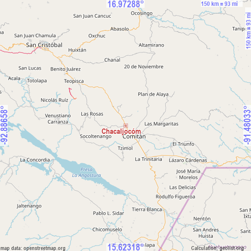
Chacaljocóm GPS coordinates[2]
16° 17' 57.084" North, 92° 11' 0.42" West
| Map corner | latitude | longitude |
|---|---|---|
| Upper-left | 16.97288°, | -92.88658° |
| Center: | 16.29919°, | -92.18345° |
| Lower-right: | 15.62318°, | -91.48033° |
| Map W x H: | 150.1×150.1 km | = 93.3×93.3mi |
| max Lat: | 32.7° ⇑95.7% North |
| Chacaljocóm: | 16.29919° |
| min Lat: | ⇓4.3% South 14.53588° |
| min Long | Chacaljocóm | max Long |
| -117.105° | -92.18345° | -86.73105° |
| W 94.3%⇐ | ⇒5.7% E |
Elevation
Elevation of Chacaljocóm is 1823 m = 5981 ft, and this is 569.3 m = 1868 ft above average elevation for this country.
| Max E: |
3497 m = 11473 ft | 35.2% |
| Chacaljocóm | 1823 m 5981 ft | |
| Avg. | 1253.7 m = 4113 ft | |
Min E: |
-1 m = -3 ft | 64.8% |
See also: Mexico elevation on elevation.city.
Geographical zone
Chacaljocóm is located in North Torrid zone (between Equator and Tropic of Cancer). Distance of this Northern Tropic circle is 793.6 km =493.1 mi to North.| Distance of | km | miles | from Chacaljocóm |
|---|---|---|---|
| North Pole | 8194.8 | 5092 | to North |
| Arctic Circle | 5588.9 | 3472.8 | to North |
| Tropic Cancer | 793.6 | 493.1 | to North |
| Equator | 1812.3 | 1126.1 | to South |


Nearby cities:
15 places around Chacaljocóm: (largest is in red/bold)
• Abelardo L. Rodríguez
10.9 km =6.8 mi,  326°
326°
• Cash
9.9 km =6.2 mi,  113°
113°
• Comitán
7.8 km =4.8 mi,  138°
138°
• Efraín A. Gutiérrez
5.3 km =3.3 mi,  341°
341°
• Los Riegos
6.3 km =3.9 mi,  84°
84°
• Ochusjob
11 km =6.8 mi,  221°
221°
• Quija
4.9 km =3 mi,  126°
126°
• Río Grande
6.7 km =4.2 mi, 109°
• San Francisco el Rincón
5.7 km =3.5 mi, 110°
• San Isidro Tinajab
7.9 km =4.9 mi,  98°
98°
• San Miguel Tinajab
8.8 km =5.5 mi, 102°
• San Rafael Jocom
6 km =3.7 mi,  92°
92°
• Santo Domingo de las Granadas
7.1 km =4.4 mi, 83°
• Señor del Pozo
7.7 km =4.8 mi, 92°
• Yaltzi Tres Lagunas
8.1 km =5 mi,  270°
270°
Sources, notices
• [Note1] Compared only with cities in Mexico existing in our database
• [Src1] Map data: © OpenStreetMap contributors (CC-BY-SA)
• [Src2] Other city data from geonames.org with taken over terms of usage.
• [Src3] Geographical zone / Annual Mean Temperature by Robert A. Rohde @ Wikipedia
