Pueblo Nuevo (San Cayetano) geodata
Pueblo Nuevo (San Cayetano) (Chiapas) is a populated place; located in Mexico in America/Mexico_City (GMT-6) time zone. With population of 983 people, there are 8847 cities with bigger population in this country. Compared to other cities in Mexico, 97.6% of cities are located further ↑North; 86.3% of cities are located further ←West and 98.1% of cities have higher elevation than Pueblo Nuevo (San Cayetano). Note1
Current local time in Pueblo Nuevo (San Cayetano):
06:53 AM, WednesdayDifference from your time zone: hours


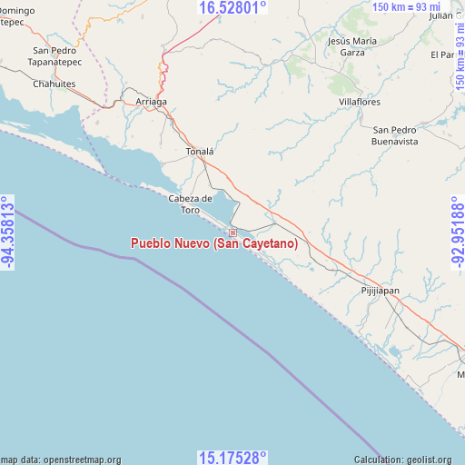
Pueblo Nuevo (San Cayetano) GPS coordinates[2]
15° 51' 10.008" North, 93° 39' 18" West
| Map corner | latitude | longitude |
|---|---|---|
| Upper-left | 16.52801°, | -94.35813° |
| Center: | 15.85278°, | -93.655° |
| Lower-right: | 15.17528°, | -92.95188° |
| Map W x H: | 150.4×150.4 km | = 93.5×93.5mi |
| max Lat: | 32.7° ⇑97.6% North |
| Pueblo Nuevo (San Cayetano): | 15.85278° |
| min Lat: | ⇓2.4% South 14.53588° |
| min Long | Pueblo Nuevo (S | max Long |
| -117.105° | -93.655° | -86.73105° |
| W 86.3%⇐ | ⇒13.7% E |
Elevation
Elevation of Pueblo Nuevo (San Cayetano) is 8 m = 26 ft, and this is 1245.7 m = 4087 ft below average elevation for this country.
| Max E: |
3497 m = 11473 ft | 98.1% |
| Avg. | 1253.7 m = 4113 ft | |
| Pueblo Nuevo (San Cayetano) | 8 m = 26 ft | |
Min E: |
-1 m = -3 ft | 1.9% |
See also: Mexico elevation on elevation.city.
Geographical zone
Pueblo Nuevo (San Cayetano) is located in North Torrid zone (between Equator and Tropic of Cancer). Distance of this Northern Tropic circle is 843.3 km =524 mi to North.| Distance of | km | miles | from Pueblo Nuevo (San Cayetano) |
|---|---|---|---|
| North Pole | 8244.4 | 5122.8 | to North |
| Arctic Circle | 5638.5 | 3503.6 | to North |
| Tropic Cancer | 843.3 | 524 | to North |
| Equator | 1762.7 | 1095.3 | to South |


Nearby cities:
15 places around Pueblo Nuevo (San Cayetano): (largest is in red/bold)
• Cabeza de Toro
16.5 km =10.3 mi,  304°
304°
• Doctor Belisario Domínguez (La Barra)
6.6 km =4.1 mi,  307°
307°
• El Congreso
26.2 km =16.3 mi,  326°
326°
• El Manguito
17.1 km =10.6 mi,  127°
127°
• Josefa Ortiz de Domínguez (La Esmeralda)
17.4 km =10.8 mi,  335°
335°
• La Laguna
23.2 km =14.4 mi,  315°
315°
• La Polka
11.7 km =7.3 mi,  355°
355°
• Llano Largo
24 km =14.9 mi, 321°
• Manuel Ávila Camacho (Ponte Duro)
8.5 km =5.3 mi,  124°
124°
• Miguel Hidalgo Número Dos (Veinte de Noviembre)
19.8 km =12.3 mi, 303°
• Noyola
23.9 km =14.9 mi, 329°
• Puerto Arista
18.9 km =11.7 mi, 298°
• Tres Picos
13.9 km =8.6 mi,  76°
76°
• Vicente Guerrero
19.3 km =12 mi, 328°
• Villahermosa
25.3 km =15.7 mi, 316°
Sources, notices
• [Note1] Compared only with cities in Mexico existing in our database
• [Src1] Map data: © OpenStreetMap contributors (CC-BY-SA)
• [Src2] Other city data from geonames.org with taken over terms of usage.
• [Src3] Geographical zone / Annual Mean Temperature by Robert A. Rohde @ Wikipedia
