Llano Largo geodata
Llano Largo (Chiapas) is a populated place; located in Mexico in America/Mexico_City (GMT-6) time zone. With population of 531 people, there are 15939 cities with bigger population in this country. Compared to other cities in Mexico, 97.2% of cities are located further ↑North; 86.1% of cities are located further ←West and 95.1% of cities have higher elevation than Llano Largo. Note1


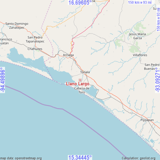
Llano Largo GPS coordinates[2]
16° 1' 17.004" North, 93° 47' 44.988" West
| Map corner | latitude | longitude |
|---|---|---|
| Upper-left | 16.69605°, | -94.49896° |
| Center: | 16.02139°, | -93.79583° |
| Lower-right: | 15.34445°, | -93.09271° |
| Map W x H: | 150.3×150.3 km | = 93.4×93.4mi |
| max Lat: | 32.7° ⇑97.2% North |
| Llano Largo: | 16.02139° |
| min Lat: | ⇓2.8% South 14.53588° |
| min Long | Llano Largo | max Long |
| -117.105° | -93.79583° | -86.73105° |
| W 86.1%⇐ | ⇒13.9% E |
Elevation
Elevation of Llano Largo is 13 m = 43 ft, and this is 1240.7 m = 4071 ft below average elevation for this country.
| Max E: |
3497 m = 11473 ft | 95.1% |
| Avg. | 1253.7 m = 4113 ft | |
| Llano Largo | 13 m = 43 ft | |
Min E: |
-1 m = -3 ft | 4.9% |
See also: Mexico elevation on elevation.city.
Geographical zone
Llano Largo is located in North Torrid zone (between Equator and Tropic of Cancer). Distance of this Northern Tropic circle is 824.5 km =512.3 mi to North.| Distance of | km | miles | from Llano Largo |
|---|---|---|---|
| North Pole | 8225.7 | 5111.2 | to North |
| Arctic Circle | 5619.8 | 3492 | to North |
| Tropic Cancer | 824.5 | 512.3 | to North |
| Equator | 1781.4 | 1106.9 | to South |


Nearby cities:
15 places around Llano Largo: (largest is in red/bold)
• Cabeza de Toro
9.5 km =5.9 mi,  171°
171°
• Democrática Chiapaneca
7.5 km =4.7 mi,  12°
12°
• El Congreso
3.2 km =2 mi, 11°
• Huizachal
3.4 km =2.1 mi,  352°
352°
• Josefa Ortiz de Domínguez (La Esmeralda)
8.3 km =5.2 mi,  111°
111°
• La Laguna
2.4 km =1.5 mi,  207°
207°
• Miguel Hidalgo Número Dos (Veinte de Noviembre)
7.9 km =4.9 mi,  190°
190°
• Noyola
3.6 km =2.2 mi,  57°
57°
• Paredón
8.2 km =5.1 mi,  293°
293°
• Puerto Arista
9.8 km =6.1 mi, 188°
• San Luqueño
5.4 km =3.4 mi,  259°
259°
• San Nicolás
4.4 km =2.7 mi,  342°
342°
• Tonalá
8.8 km =5.5 mi,  29°
29°
• Vicente Guerrero
5.5 km =3.4 mi, 114°
• Villahermosa
2.5 km =1.6 mi, 258°
Sources, notices
• [Note1] Compared only with cities in Mexico existing in our database
• [Src1] Map data: © OpenStreetMap contributors (CC-BY-SA)
• [Src2] Other city data from geonames.org with taken over terms of usage.
• [Src3] Geographical zone / Annual Mean Temperature by Robert A. Rohde @ Wikipedia
