Tres Picos geodata
Tres Picos (Chiapas) is a populated place; located in Mexico in America/Mexico_City (GMT-6) time zone. With population of 4,403 people, there are 2082 cities with bigger population in this country. Compared to other cities in Mexico, 97.6% of cities are located further ↑North; 86.5% of cities are located further ←West and 88.6% of cities have higher elevation than Tres Picos. Note1


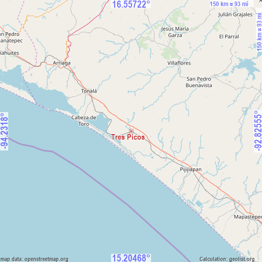
Tres Picos GPS coordinates[2]
15° 52' 55.524" North, 93° 31' 43.212" West
| Map corner | latitude | longitude |
|---|---|---|
| Upper-left | 16.55722°, | -94.2318° |
| Center: | 15.88209°, | -93.52867° |
| Lower-right: | 15.20468°, | -92.82555° |
| Map W x H: | 150.4×150.4 km | = 93.5×93.5mi |
| max Lat: | 32.7° ⇑97.6% North |
| Tres Picos: | 15.88209° |
| min Lat: | ⇓2.4% South 14.53588° |
| min Long | Tres Picos | max Long |
| -117.105° | -93.52867° | -86.73105° |
| W 86.5%⇐ | ⇒13.5% E |
Elevation
Elevation of Tres Picos is 28 m = 92 ft, and this is 1225.7 m = 4021 ft below average elevation for this country.
| Max E: |
3497 m = 11473 ft | 88.6% |
| Avg. | 1253.7 m = 4113 ft | |
| Tres Picos | 28 m = 92 ft | |
Min E: |
-1 m = -3 ft | 11.4% |
See also: Mexico elevation on elevation.city.
Geographical zone
Tres Picos is located in North Torrid zone (between Equator and Tropic of Cancer). Distance of this Northern Tropic circle is 840 km =522 mi to North.| Distance of | km | miles | from Tres Picos |
|---|---|---|---|
| North Pole | 8241.1 | 5120.8 | to North |
| Arctic Circle | 5635.3 | 3501.6 | to North |
| Tropic Cancer | 840 | 522 | to North |
| Equator | 1765.9 | 1097.3 | to South |


Nearby cities:
15 places around Tres Picos: (largest is in red/bold)
• Cabeza de Toro
27.8 km =17.3 mi,  282°
282°
• Colonia Central
29.9 km =18.6 mi,  125°
125°
• Doctor Belisario Domínguez (La Barra)
18.8 km =11.7 mi,  272°
272°
• El Manguito
13.7 km =8.5 mi,  179°
179°
• Josefa Ortiz de Domínguez (La Esmeralda)
24.2 km =15 mi,  301°
301°
• La Polka
16.7 km =10.4 mi, 300°
• Manuel Ávila Camacho (Ponte Duro)
10.3 km =6.4 mi,  218°
218°
• Miguel Hidalgo Número Dos (Veinte de Noviembre)
31 km =19.3 mi, 284°
• Monterrey
26.3 km =16.3 mi,  40°
40°
• Noyola
30.9 km =19.2 mi, 304°
• Pueblo Nuevo (San Cayetano)
13.9 km =8.6 mi,  256°
256°
• Puerto Arista
30.6 km =19 mi, 280°
• San Isidro
24.3 km =15.1 mi, 129°
• Tamaulipas
17.9 km =11.1 mi, 133°
• Vicente Guerrero
27 km =16.8 mi, 299°
Sources, notices
• [Note1] Compared only with cities in Mexico existing in our database
• [Src1] Map data: © OpenStreetMap contributors (CC-BY-SA)
• [Src2] Other city data from geonames.org with taken over terms of usage.
• [Src3] Geographical zone / Annual Mean Temperature by Robert A. Rohde @ Wikipedia
