Huitzoltepec geodata
Huitzoltepec (State of Mexico) is a populated place; located in Mexico in America/Mexico_City (GMT-6) time zone. With population of 1,010 people, there are 8622 cities with bigger population in this country. Compared to other cities in Mexico, 69.2% of cities are located further ↑North; 61.5% of cities are located further →East and 71.9% of cities have lower elevation than Huitzoltepec. Note1


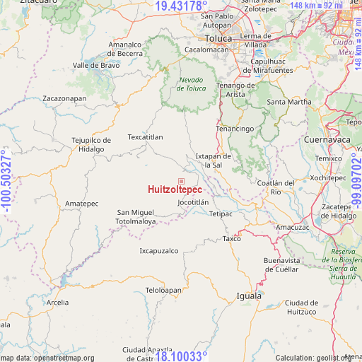
Huitzoltepec GPS coordinates[2]
18° 46' 2.532" North, 99° 48' 0.504" West
| Map corner | latitude | longitude |
|---|---|---|
| Upper-left | 19.43178°, | -100.50327° |
| Center: | 18.76737°, | -99.80014° |
| Lower-right: | 18.10033°, | -99.09702° |
| Map W x H: | 148×148 km | = 92×92mi |
| max Lat: | 32.7° ⇑69.2% North |
| Huitzoltepec: | 18.76737° |
| min Lat: | ⇓30.8% South 14.53588° |
| min Long | Huitzoltepec | max Long |
| -117.105° | -99.80014° | -86.73105° |
| W 38.5%⇐ | ⇒61.5% E |
Elevation
Elevation of Huitzoltepec is 1965 m = 6447 ft, and this is 711.3 m = 2334 ft above average elevation for this country.
| Max E: |
3497 m = 11473 ft | 28.1% |
| Huitzoltepec | 1965 m 6447 ft | |
| Avg. | 1253.7 m = 4113 ft | |
Min E: |
-1 m = -3 ft | 71.9% |
See also: Mexico elevation on elevation.city.
Geographical zone
Huitzoltepec is located in North Torrid zone (between Equator and Tropic of Cancer). Distance of this Northern Tropic circle is 519.2 km =322.6 mi to North.| Distance of | km | miles | from Huitzoltepec |
|---|---|---|---|
| North Pole | 7920.3 | 4921.4 | to North |
| Arctic Circle | 5314.4 | 3302.2 | to North |
| Tropic Cancer | 519.2 | 322.6 | to North |
| Equator | 2086.7 | 1296.6 | to South |


Nearby cities:
15 places around Huitzoltepec: (largest is in red/bold)
• Ayotuxco
2.9 km =1.8 mi,  185°
185°
• Colonia 3 de Mayo
13.1 km =8.1 mi,  59°
59°
• El Refugio
11.4 km =7.1 mi,  52°
52°
• Jocotitlán
9.7 km =6 mi,  149°
149°
• La Concepción (La Concha)
11.3 km =7 mi,  89°
89°
• Llano Grande
7.5 km =4.7 mi,  27°
27°
• Malinaltenango
9.5 km =5.9 mi,  80°
80°
• Mesón Nuevo
10 km =6.2 mi, 61°
• Piedra Parada
7 km =4.3 mi, 79°
• Plan de Vigas
9.4 km =5.8 mi,  295°
295°
• Potzontepec
10.3 km =6.4 mi,  251°
251°
• San Alejo
10.9 km =6.8 mi,  43°
43°
• San José Tizates
7.9 km =4.9 mi,  351°
351°
• Tecomatepec
12.9 km =8 mi, 51°
• Zacualpan
6 km =3.7 mi, 154°
Sources, notices
• [Note1] Compared only with cities in Mexico existing in our database
• [Src1] Map data: © OpenStreetMap contributors (CC-BY-SA)
• [Src2] Other city data from geonames.org with taken over terms of usage.
• [Src3] Geographical zone / Annual Mean Temperature by Robert A. Rohde @ Wikipedia
