El Refugio geodata
El Refugio (State of Mexico) is a populated place; located in Mexico in America/Mexico_City (GMT-6) time zone. With population of 559 people, there are 15266 cities with bigger population in this country. Compared to other cities in Mexico, 68.2% of cities are located further ↑North; 60.4% of cities are located further →East and 65.1% of cities have lower elevation than El Refugio. Note1


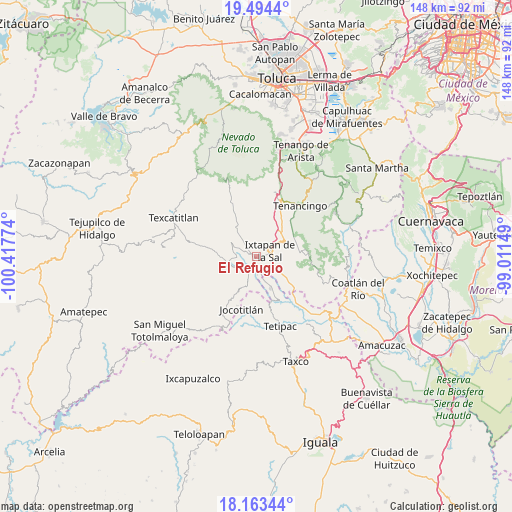
El Refugio GPS coordinates[2]
18° 49' 48.864" North, 99° 42' 52.596" West
| Map corner | latitude | longitude |
|---|---|---|
| Upper-left | 19.4944°, | -100.41774° |
| Center: | 18.83024°, | -99.71461° |
| Lower-right: | 18.16344°, | -99.01149° |
| Map W x H: | 148×148 km | = 92×92mi |
| max Lat: | 32.7° ⇑68.2% North |
| El Refugio: | 18.83024° |
| min Lat: | ⇓31.8% South 14.53588° |
| min Long | El Refugio | max Long |
| -117.105° | -99.71461° | -86.73105° |
| W 39.6%⇐ | ⇒60.4% E |
Elevation
Elevation of El Refugio is 1833 m = 6014 ft, and this is 579.3 m = 1901 ft above average elevation for this country.
| Max E: |
3497 m = 11473 ft | 34.9% |
| El Refugio | 1833 m 6014 ft | |
| Avg. | 1253.7 m = 4113 ft | |
Min E: |
-1 m = -3 ft | 65.1% |
See also: Mexico elevation on elevation.city.
Geographical zone
El Refugio is located in North Torrid zone (between Equator and Tropic of Cancer). Distance of this Northern Tropic circle is 512.2 km =318.3 mi to North.| Distance of | km | miles | from El Refugio |
|---|---|---|---|
| North Pole | 7913.3 | 4917.1 | to North |
| Arctic Circle | 5307.4 | 3297.9 | to North |
| Tropic Cancer | 512.2 | 318.3 | to North |
| Equator | 2093.7 | 1301 | to South |


Nearby cities:
15 places around El Refugio: (largest is in red/bold)
• Ahuacatitlán
7.1 km =4.4 mi,  5°
5°
• Coatepec Harinas
7.2 km =4.5 mi,  354°
354°
• Colonia 3 de Mayo
2.3 km =1.4 mi,  98°
98°
• El Salitre
5 km =3.1 mi, 99°
• Ixtapan de la Sal
4.3 km =2.7 mi,  69°
69°
• Llano Grande
5.6 km =3.5 mi,  266°
266°
• Malinaltenango
5.5 km =3.4 mi,  175°
175°
• Mesón Nuevo
2.3 km =1.4 mi,  185°
185°
• Piedra Parada
6.1 km =3.8 mi,  200°
200°
• San Alejo
1.8 km =1.1 mi,  301°
301°
• San Gaspar Tonatico
5.5 km =3.4 mi,  118°
118°
• San José del Arenal
4.2 km =2.6 mi, 8°
• San Miguel Laderas
6.2 km =3.9 mi,  17°
17°
• Tecomatepec
1.5 km =0.9 mi,  49°
49°
• Yerbas Buenas
5.5 km =3.4 mi,  356°
356°
Sources, notices
• [Note1] Compared only with cities in Mexico existing in our database
• [Src1] Map data: © OpenStreetMap contributors (CC-BY-SA)
• [Src2] Other city data from geonames.org with taken over terms of usage.
• [Src3] Geographical zone / Annual Mean Temperature by Robert A. Rohde @ Wikipedia
