San Gaspar geodata
San Gaspar (State of Mexico) is a populated place; located in Mexico in America/Mexico_City (GMT-6) time zone. With population of 1,881 people, there are 4622 cities with bigger population in this country. Compared to other cities in Mexico, 69.1% of cities are located further ↑North; 57.6% of cities are located further →East and 56.5% of cities have lower elevation than San Gaspar. Note1


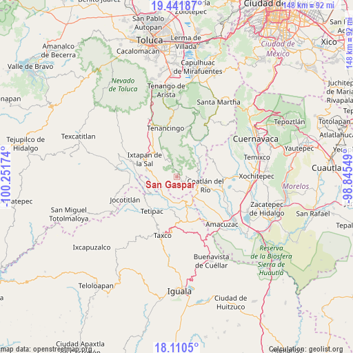
San Gaspar GPS coordinates[2]
18° 46' 39" North, 99° 32' 54.996" West
| Map corner | latitude | longitude |
|---|---|---|
| Upper-left | 19.44187°, | -100.25174° |
| Center: | 18.7775°, | -99.54861° |
| Lower-right: | 18.1105°, | -98.84549° |
| Map W x H: | 148×148 km | = 92×92mi |
| max Lat: | 32.7° ⇑69.1% North |
| San Gaspar: | 18.7775° |
| min Lat: | ⇓30.9% South 14.53588° |
| min Long | San Gaspar | max Long |
| -117.105° | -99.54861° | -86.73105° |
| W 42.4%⇐ | ⇒57.6% E |
Elevation
Elevation of San Gaspar is 1639 m = 5377 ft, and this is 385.3 m = 1264 ft above average elevation for this country.
| Max E: |
3497 m = 11473 ft | 43.5% |
| San Gaspar | 1639 m 5377 ft | |
| Avg. | 1253.7 m = 4113 ft | |
Min E: |
-1 m = -3 ft | 56.5% |
See also: Mexico elevation on elevation.city.
Geographical zone
San Gaspar is located in North Torrid zone (between Equator and Tropic of Cancer). Distance of this Northern Tropic circle is 518.1 km =321.9 mi to North.| Distance of | km | miles | from San Gaspar |
|---|---|---|---|
| North Pole | 7919.2 | 4920.8 | to North |
| Arctic Circle | 5313.3 | 3301.5 | to North |
| Tropic Cancer | 518.1 | 321.9 | to North |
| Equator | 2087.9 | 1297.4 | to South |


Nearby cities:
15 places around San Gaspar: (largest is in red/bold)
• Chavarría
10.2 km =6.3 mi,  124°
124°
• Cocoyotla
10.6 km =6.6 mi,  103°
103°
• Colonia Guadalupe Victoria
8 km =5 mi, 104°
• Colonia Juárez
10 km =6.2 mi,  74°
74°
• Colonia Morelos
9.2 km =5.7 mi, 98°
• El Progreso Hidalgo
10.3 km =6.4 mi,  317°
317°
• El Terrero
10.3 km =6.4 mi,  277°
277°
• La Ascensión
7.4 km =4.6 mi,  337°
337°
• La Puerta de Santiago
8.1 km =5 mi,  260°
260°
• Noxtepec de Zaragoza (El Aguacate)
8.3 km =5.2 mi,  62°
62°
• San Andrés Nicolás Bravo
8.8 km =5.5 mi, 97°
• San José Chalmita
9 km =5.6 mi,  0°
0°
• San Juan
8.2 km =5.1 mi, 336°
• Tilancingo
10.9 km =6.8 mi,  114°
114°
• Zumpahuacán
7.5 km =4.7 mi,  332°
332°
Sources, notices
• [Note1] Compared only with cities in Mexico existing in our database
• [Src1] Map data: © OpenStreetMap contributors (CC-BY-SA)
• [Src2] Other city data from geonames.org with taken over terms of usage.
• [Src3] Geographical zone / Annual Mean Temperature by Robert A. Rohde @ Wikipedia
