El Platanar geodata
El Platanar (State of Mexico) is a populated place; located in Mexico in America/Mexico_City (GMT-6) time zone. With population of 609 people, there are 14153 cities with bigger population in this country. Compared to other cities in Mexico, 68.2% of cities are located further ↑North; 56.3% of cities are located further →East and 53.5% of cities have higher elevation than El Platanar. Note1


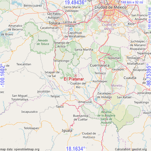
El Platanar GPS coordinates[2]
18° 49' 48.72" North, 99° 27' 25.452" West
| Map corner | latitude | longitude |
|---|---|---|
| Upper-left | 19.49436°, | -100.1602° |
| Center: | 18.8302°, | -99.45707° |
| Lower-right: | 18.1634°, | -98.75395° |
| Map W x H: | 148×148 km | = 92×92mi |
| max Lat: | 32.7° ⇑68.2% North |
| El Platanar: | 18.8302° |
| min Lat: | ⇓31.8% South 14.53588° |
| min Long | El Platanar | max Long |
| -117.105° | -99.45707° | -86.73105° |
| W 43.7%⇐ | ⇒56.3% E |
Elevation
Elevation of El Platanar is 1268 m = 4160 ft, and this is 14.3 m = 47 ft above average elevation for this country.
| Max E: |
3497 m = 11473 ft | 53.5% |
| El Platanar | 1268 m 4160 ft | |
| Avg. | 1253.7 m = 4113 ft | |
Min E: |
-1 m = -3 ft | 46.5% |
See also: Mexico elevation on elevation.city.
Geographical zone
El Platanar is located in North Torrid zone (between Equator and Tropic of Cancer). Distance of this Northern Tropic circle is 512.2 km =318.3 mi to North.| Distance of | km | miles | from El Platanar |
|---|---|---|---|
| North Pole | 7913.3 | 4917.1 | to North |
| Arctic Circle | 5307.5 | 3297.9 | to North |
| Tropic Cancer | 512.2 | 318.3 | to North |
| Equator | 2093.7 | 1301 | to South |


Nearby cities:
15 places around El Platanar: (largest is in red/bold)
• Coatlán del Río
9.9 km =6.2 mi,  165°
165°
• Cocoyotla
8.4 km =5.2 mi,  175°
175°
• Colonia Cuauhtémoc
8.8 km =5.5 mi, 171°
• Colonia Guadalupe Victoria
8 km =5 mi,  193°
193°
• Colonia Juárez
3.1 km =1.9 mi, 180°
• Colonia Morelos
7.2 km =4.5 mi, 184°
• El Puentecito
9.7 km =6 mi,  350°
350°
• Jalmolonga (La Hacienda)
10.5 km =6.5 mi,  338°
338°
• Los Manantiales (El Río Chiquito)
10.9 km =6.8 mi,  10°
10°
• Noxtepec de Zaragoza (El Aguacate)
3 km =1.9 mi,  226°
226°
• Palpan de Baranda
5.2 km =3.2 mi,  33°
33°
• Puente Caporal (La Guancha)
8 km =5 mi,  1°
1°
• San Andrés Nicolás Bravo
7 km =4.3 mi, 187°
• San José Chalmita
10.1 km =6.3 mi,  288°
288°
• Tilancingo
10.3 km =6.4 mi, 178°
Sources, notices
• [Note1] Compared only with cities in Mexico existing in our database
• [Src1] Map data: © OpenStreetMap contributors (CC-BY-SA)
• [Src2] Other city data from geonames.org with taken over terms of usage.
• [Src3] Geographical zone / Annual Mean Temperature by Robert A. Rohde @ Wikipedia
