San Sebastián Chimalpa geodata
San Sebastián Chimalpa (State of Mexico) is a section of populated place; located in Mexico in America/Mexico_City (GMT-6) time zone. With population of 12,951 people, there are 756 cities with bigger population in this country. Compared to other cities in Mexico, 56.7% of cities are located further ↑North; 51% of cities are located further ←West and 83.9% of cities have lower elevation than San Sebastián Chimalpa. Note1
Current local time in San Sebastián Chimalpa:
04:05 AM, TuesdayDifference from your time zone: hours


San Sebastián Chimalpa GPS coordinates[2]
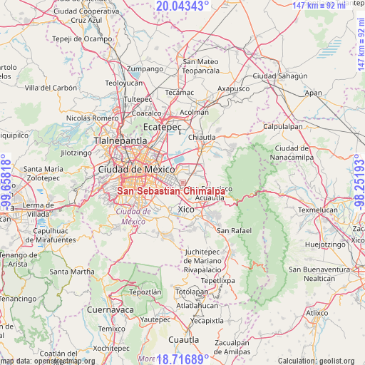
19° 22' 53.436" North, 98° 57' 18.18" West
| Map corner | latitude | longitude |
|---|---|---|
| Upper-left | 20.04343°, | -99.65818° |
| Center: | 19.38151°, | -98.95505° |
| Lower-right: | 18.71689°, | -98.25193° |
| Map W x H: | 147.5×147.5 km | = 91.7×91.7mi |
| max Lat: | 32.7° ⇑56.7% North |
| San Sebastián Chimalpa: | 19.38151° |
| min Lat: | ⇓43.3% South 14.53588° |
| min Long | San Sebastián | max Long |
| -117.105° | -98.95505° | -86.73105° |
| W 51%⇐ | ⇒49% E |
Elevation
Elevation of San Sebastián Chimalpa is 2241 m = 7352 ft, and this is 987.3 m = 3239 ft above average elevation for this country.
| Max E: |
3497 m = 11473 ft | 16.1% |
| San Sebastián Chimalpa | 2241 m 7352 ft | |
| Avg. | 1253.7 m = 4113 ft | |
Min E: |
-1 m = -3 ft | 83.9% |
See also: Mexico elevation on elevation.city.
Geographical zone
San Sebastián Chimalpa is located in North Torrid zone (between Equator and Tropic of Cancer). Distance of this Northern Tropic circle is 450.9 km =280.2 mi to North.| Distance of | km | miles | from San Sebastián Chimalpa |
|---|---|---|---|
| North Pole | 7852 | 4879 | to North |
| Arctic Circle | 5246.2 | 3259.8 | to North |
| Tropic Cancer | 450.9 | 280.2 | to North |
| Equator | 2155 | 1339.1 | to South |


Nearby cities:
15 places around San Sebastián Chimalpa: (largest is in red/bold)
• Arenal
1.3 km =0.8 mi,  91°
91°
• Bosques de la Magdalena
2.8 km =1.7 mi,  163°
163°
• El Pino
3.4 km =2.1 mi,  168°
168°
• Lomas de Altavista
2.5 km =1.6 mi,  154°
154°
• Lomas de San Sebastián
2.3 km =1.4 mi, 88°
• Los Reyes Acaquilpan
3.1 km =1.9 mi,  229°
229°
• Magdalena Atlicpac
1.5 km =0.9 mi, 156°
• Nezahualcóyotl
4 km =2.5 mi,  279°
279°
• Profesor Carlos Hank González
2 km =1.2 mi,  121°
121°
• San Isidro
4.7 km =2.9 mi, 174°
• San José las Palmas
2.7 km =1.7 mi,  125°
125°
• Santa María Chimalhuacán
4.5 km =2.8 mi,  6°
6°
• Tecamachalco
2.4 km =1.5 mi,  191°
191°
• Techachaltitla
2.4 km =1.5 mi,  140°
140°
• Unidad Acaquilpan
2.3 km =1.4 mi, 134°
Sources, notices
• [Note1] Compared only with cities in Mexico existing in our database
• [Src1] Map data: © OpenStreetMap contributors (CC-BY-SA)
• [Src2] Other city data from geonames.org with taken over terms of usage.
• [Src3] Geographical zone / Annual Mean Temperature by Robert A. Rohde @ Wikipedia
