San Miguel Atlamajac geodata
San Miguel Atlamajac (State of Mexico) is a populated place; located in Mexico in America/Mexico_City (GMT-6) time zone. With population of 2,088 people, there are 4179 cities with bigger population in this country. Compared to other cities in Mexico, 51.5% of cities are located further ↓South; 51.4% of cities are located further ←West and 86.8% of cities have lower elevation than San Miguel Atlamajac. Note1
Current local time in San Miguel Atlamajac:
12:52 AM, WednesdayDifference from your time zone: hours


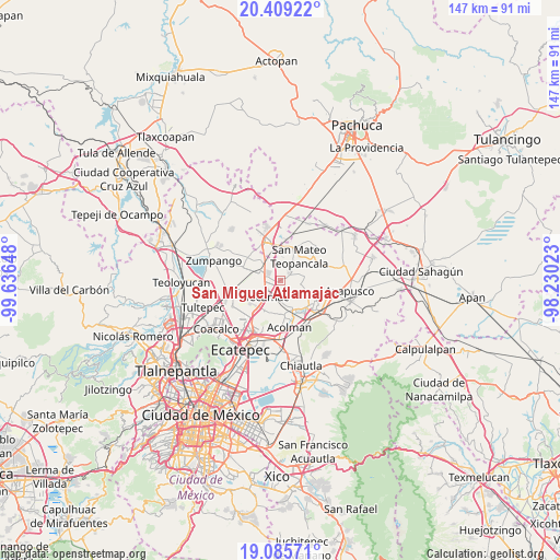
San Miguel Atlamajac GPS coordinates[2]
19° 44' 55.824" North, 98° 56' 0.06" West
| Map corner | latitude | longitude |
|---|---|---|
| Upper-left | 20.40922°, | -99.63648° |
| Center: | 19.74884°, | -98.93335° |
| Lower-right: | 19.08571°, | -98.23023° |
| Map W x H: | 147.2×147.2 km | = 91.5×91.5mi |
| max Lat: | 32.7° ⇑48.5% North |
| San Miguel Atlamajac: | 19.74884° |
| min Lat: | ⇓51.5% South 14.53588° |
| min Long | San Miguel Atla | max Long |
| -117.105° | -98.93335° | -86.73105° |
| W 51.4%⇐ | ⇒48.6% E |
Elevation
Elevation of San Miguel Atlamajac is 2305 m = 7562 ft, and this is 1051.3 m = 3449 ft above average elevation for this country.
| Max E: |
3497 m = 11473 ft | 13.2% |
| San Miguel Atlamajac | 2305 m 7562 ft | |
| Avg. | 1253.7 m = 4113 ft | |
Min E: |
-1 m = -3 ft | 86.8% |
See also: Mexico elevation on elevation.city.
Geographical zone
San Miguel Atlamajac is located in North Torrid zone (between Equator and Tropic of Cancer). Distance of this Northern Tropic circle is 410.1 km =254.8 mi to North.| Distance of | km | miles | from San Miguel Atlamajac |
|---|---|---|---|
| North Pole | 7811.2 | 4853.7 | to North |
| Arctic Circle | 5205.3 | 3234.4 | to North |
| Tropic Cancer | 410.1 | 254.8 | to North |
| Equator | 2195.9 | 1364.5 | to South |


Nearby cities:
15 places around San Miguel Atlamajac: (largest is in red/bold)
• Ex-Hacienda de Guadalupe
7.8 km =4.8 mi,  328°
328°
• Fraccionamiento Hacienda del Bosque
4.4 km =2.7 mi,  236°
236°
• Huitzila
7.3 km =4.5 mi,  341°
341°
• Ixtlahuaca
6 km =3.7 mi,  101°
101°
• Reyes Acozac
5.8 km =3.6 mi,  300°
300°
• San Agustín Actipac
4.2 km =2.6 mi,  116°
116°
• San Isidro del Progreso
4.8 km =3 mi,  156°
156°
• San Luis Tecuhautitlán
5.1 km =3.2 mi,  66°
66°
• Sanata Lucía
5 km =3.1 mi,  269°
269°
• Santa Ana Tlachiahualpa
3.4 km =2.1 mi,  49°
49°
• Santa María Ajoloapan
3.2 km =2 mi, 301°
• Santiago Zacualuca
5.4 km =3.4 mi,  175°
175°
• Tecámac
5.5 km =3.4 mi,  222°
222°
• Tecámac de Felipe Villanueva
5.4 km =3.4 mi, 222°
• Teopancala
8.1 km =5 mi,  37°
37°
Sources, notices
• [Note1] Compared only with cities in Mexico existing in our database
• [Src1] Map data: © OpenStreetMap contributors (CC-BY-SA)
• [Src2] Other city data from geonames.org with taken over terms of usage.
• [Src3] Geographical zone / Annual Mean Temperature by Robert A. Rohde @ Wikipedia
