Santiago Zacualuca geodata
Santiago Zacualuca (State of Mexico) is a populated place; located in Mexico in America/Mexico_City (GMT-6) time zone. With population of 2,546 people, there are 3480 cities with bigger population in this country. Compared to other cities in Mexico, 50.4% of cities are located further ↓South; 51.5% of cities are located further ←West and 87% of cities have lower elevation than Santiago Zacualuca. Note1


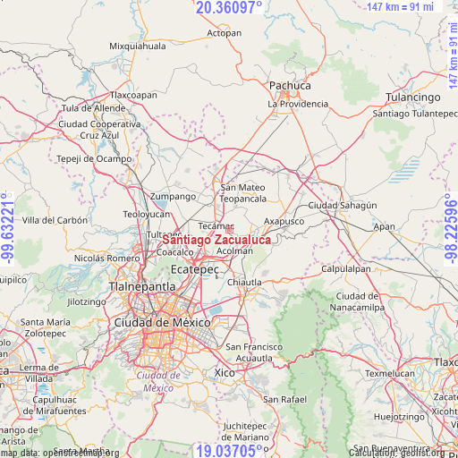
Santiago Zacualuca GPS coordinates[2]
19° 42' 1.368" North, 98° 55' 44.688" West
| Map corner | latitude | longitude |
|---|---|---|
| Upper-left | 20.36097°, | -99.63221° |
| Center: | 19.70038°, | -98.92908° |
| Lower-right: | 19.03705°, | -98.22596° |
| Map W x H: | 147.2×147.2 km | = 91.5×91.5mi |
| max Lat: | 32.7° ⇑49.6% North |
| Santiago Zacualuca: | 19.70038° |
| min Lat: | ⇓50.4% South 14.53588° |
| min Long | Santiago Zacual | max Long |
| -117.105° | -98.92908° | -86.73105° |
| W 51.5%⇐ | ⇒48.5% E |
Elevation
Elevation of Santiago Zacualuca is 2310 m = 7579 ft, and this is 1056.3 m = 3466 ft above average elevation for this country.
| Max E: |
3497 m = 11473 ft | 13% |
| Santiago Zacualuca | 2310 m 7579 ft | |
| Avg. | 1253.7 m = 4113 ft | |
Min E: |
-1 m = -3 ft | 87% |
See also: Mexico elevation on elevation.city.
Geographical zone
Santiago Zacualuca is located in North Torrid zone (between Equator and Tropic of Cancer). Distance of this Northern Tropic circle is 415.4 km =258.1 mi to North.| Distance of | km | miles | from Santiago Zacualuca |
|---|---|---|---|
| North Pole | 7816.6 | 4857 | to North |
| Arctic Circle | 5210.7 | 3237.8 | to North |
| Tropic Cancer | 415.4 | 258.1 | to North |
| Equator | 2190.5 | 1361.1 | to South |


Nearby cities:
15 places around Santiago Zacualuca: (largest is in red/bold)
• Atlatongo
4.5 km =2.8 mi,  144°
144°
• Ejido Atlatongo
4.1 km =2.5 mi, 137°
• El Potrero (Ejido Purificación)
6.5 km =4 mi,  115°
115°
• Fraccionamiento Hacienda del Bosque
5.1 km =3.2 mi,  305°
305°
• Ixtlahuaca
6.9 km =4.3 mi,  52°
52°
• San Agustín Actipac
4.8 km =3 mi,  43°
43°
• San Bartolo
5.7 km =3.5 mi,  150°
150°
• San Isidro del Progreso
1.8 km =1.1 mi,  55°
55°
• San José
5 km =3.1 mi,  155°
155°
• San Marcos Nepantla
3.5 km =2.2 mi,  185°
185°
• San Martín Azcatepec
4.8 km =3 mi,  251°
251°
• San Miguel Atlamajac
5.4 km =3.4 mi,  355°
355°
• San Pablo Tecalco
4.3 km =2.7 mi,  225°
225°
• Tecámac
4.4 km =2.7 mi,  288°
288°
• Tecámac de Felipe Villanueva
4.3 km =2.7 mi, 288°
Sources, notices
• [Note1] Compared only with cities in Mexico existing in our database
• [Src1] Map data: © OpenStreetMap contributors (CC-BY-SA)
• [Src2] Other city data from geonames.org with taken over terms of usage.
• [Src3] Geographical zone / Annual Mean Temperature by Robert A. Rohde @ Wikipedia
