Soledad Morelos geodata
Soledad Morelos (Puebla) is a populated place; located in Mexico in America/Mexico_City (GMT-6) time zone. With population of 1,917 people, there are 4537 cities with bigger population in this country. Compared to other cities in Mexico, 68.3% of cities are located further ↑North; 57.4% of cities are located further ←West and 60.9% of cities have lower elevation than Soledad Morelos. Note1


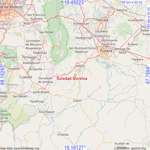
Soledad Morelos GPS coordinates[2]
18° 49' 41.088" North, 98° 29' 22.272" West
| Map corner | latitude | longitude |
|---|---|---|
| Upper-left | 19.49225°, | -99.19265° |
| Center: | 18.82808°, | -98.48952° |
| Lower-right: | 18.16127°, | -97.7864° |
| Map W x H: | 148×148 km | = 92×92mi |
| max Lat: | 32.7° ⇑68.3% North |
| Soledad Morelos: | 18.82808° |
| min Lat: | ⇓31.7% South 14.53588° |
| min Long | Soledad Morelos | max Long |
| -117.105° | -98.48952° | -86.73105° |
| W 57.4%⇐ | ⇒42.6% E |
Elevation
Elevation of Soledad Morelos is 1742 m = 5715 ft, and this is 488.3 m = 1602 ft above average elevation for this country.
| Max E: |
3497 m = 11473 ft | 39.1% |
| Soledad Morelos | 1742 m 5715 ft | |
| Avg. | 1253.7 m = 4113 ft | |
Min E: |
-1 m = -3 ft | 60.9% |
See also: Mexico elevation on elevation.city.
Geographical zone
Soledad Morelos is located in North Torrid zone (between Equator and Tropic of Cancer). Distance of this Northern Tropic circle is 512.4 km =318.4 mi to North.| Distance of | km | miles | from Soledad Morelos |
|---|---|---|---|
| North Pole | 7913.6 | 4917.3 | to North |
| Arctic Circle | 5307.7 | 3298.1 | to North |
| Tropic Cancer | 512.4 | 318.4 | to North |
| Equator | 2093.5 | 1300.8 | to South |


Nearby cities:
15 places around Soledad Morelos: (largest is in red/bold)
• Cacaloxúchitl
4.5 km =2.8 mi,  175°
175°
• Huaquechula
8.6 km =5.3 mi,  222°
222°
• Juan Uvera
8.1 km =5 mi,  60°
60°
• Mártir Cuauhtémoc (San José Cuauhtémoc)
4.4 km =2.7 mi,  135°
135°
• San Jerónimo Coyula
7.9 km =4.9 mi,  338°
338°
• San Juan Huiluco
6.1 km =3.8 mi, 135°
• San Juan Tejupa
6.2 km =3.9 mi,  298°
298°
• San Miguel Aguacomulican
6.5 km =4 mi,  264°
264°
• San Pedro Teyuca
9.1 km =5.7 mi,  152°
152°
• Santa Ana Coatepec
5.8 km =3.6 mi,  80°
80°
• Santiago Tetla
9.7 km =6 mi,  210°
210°
• Soto y Gama
7.4 km =4.6 mi, 175°
• Teacalco de Dorantes (San José Teacalco)
3.2 km =2 mi, 215°
• Tezonteopan de Bonilla
8.9 km =5.5 mi, 181°
• Tronconal
2.6 km =1.6 mi,  166°
166°
Sources, notices
• [Note1] Compared only with cities in Mexico existing in our database
• [Src1] Map data: © OpenStreetMap contributors (CC-BY-SA)
• [Src2] Other city data from geonames.org with taken over terms of usage.
• [Src3] Geographical zone / Annual Mean Temperature by Robert A. Rohde @ Wikipedia
