San Juan Huiluco geodata
San Juan Huiluco (Puebla) is a populated place; located in Mexico in America/Mexico_City (GMT-6) time zone. With population of 1,358 people, there are 6406 cities with bigger population in this country. Compared to other cities in Mexico, 68.9% of cities are located further ↑North; 57.9% of cities are located further ←West and 55.8% of cities have lower elevation than San Juan Huiluco. Note1


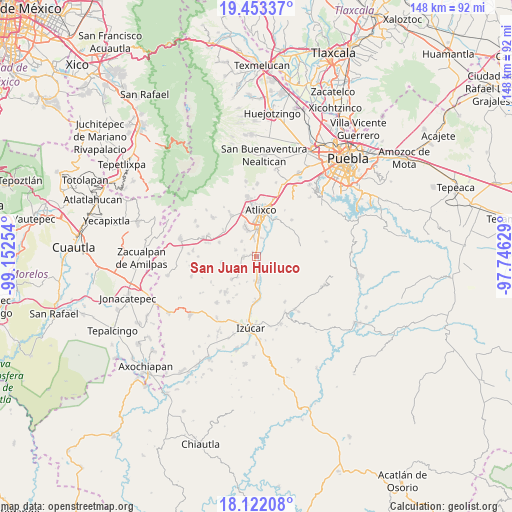
San Juan Huiluco GPS coordinates[2]
18° 47' 20.544" North, 98° 26' 57.876" West
| Map corner | latitude | longitude |
|---|---|---|
| Upper-left | 19.45337°, | -99.15254° |
| Center: | 18.78904°, | -98.44941° |
| Lower-right: | 18.12208°, | -97.74629° |
| Map W x H: | 148×148 km | = 92×92mi |
| max Lat: | 32.7° ⇑68.9% North |
| San Juan Huiluco: | 18.78904° |
| min Lat: | ⇓31.1% South 14.53588° |
| min Long | San Juan Huiluc | max Long |
| -117.105° | -98.44941° | -86.73105° |
| W 57.9%⇐ | ⇒42.1% E |
Elevation
Elevation of San Juan Huiluco is 1614 m = 5295 ft, and this is 360.3 m = 1182 ft above average elevation for this country.
| Max E: |
3497 m = 11473 ft | 44.2% |
| San Juan Huiluco | 1614 m 5295 ft | |
| Avg. | 1253.7 m = 4113 ft | |
Min E: |
-1 m = -3 ft | 55.8% |
See also: Mexico elevation on elevation.city.
Geographical zone
San Juan Huiluco is located in North Torrid zone (between Equator and Tropic of Cancer). Distance of this Northern Tropic circle is 516.8 km =321.1 mi to North.| Distance of | km | miles | from San Juan Huiluco |
|---|---|---|---|
| North Pole | 7917.9 | 4920 | to North |
| Arctic Circle | 5312 | 3300.7 | to North |
| Tropic Cancer | 516.8 | 321.1 | to North |
| Equator | 2089.1 | 1298.1 | to South |


Nearby cities:
15 places around San Juan Huiluco: (largest is in red/bold)
• Cacaloxúchitl
3.9 km =2.4 mi,  267°
267°
• Juan Uvera
8.8 km =5.5 mi,  18°
18°
• Mártir Cuauhtémoc (San José Cuauhtémoc)
1.7 km =1.1 mi,  315°
315°
• San Diego el Organal
9.6 km =6 mi,  227°
227°
• San Juan Vallarta
8.2 km =5.1 mi,  221°
221°
• San Pedro Teyuca
3.8 km =2.4 mi,  180°
180°
• Santa Ana Coatepec
5.5 km =3.4 mi, 16°
• Santa María Xoyatla
7.3 km =4.5 mi,  121°
121°
• Soledad Morelos
6.1 km =3.8 mi, 315°
• Soto y Gama
4.8 km =3 mi, 230°
• Teacalco de Dorantes (San José Teacalco)
6.3 km =3.9 mi,  285°
285°
• Tepeojuma
7.2 km =4.5 mi, 177°
• Tezonteopan de Bonilla
6.3 km =3.9 mi, 224°
• Tronconal
4 km =2.5 mi,  296°
296°
• Xoyatla
7.3 km =4.5 mi, 123°
Sources, notices
• [Note1] Compared only with cities in Mexico existing in our database
• [Src1] Map data: © OpenStreetMap contributors (CC-BY-SA)
• [Src2] Other city data from geonames.org with taken over terms of usage.
• [Src3] Geographical zone / Annual Mean Temperature by Robert A. Rohde @ Wikipedia
