Tlapetlahuaya geodata
Tlapetlahuaya (Puebla) is a populated place; located in Mexico in America/Mexico_City (GMT-6) time zone. With population of 601 people, there are 14318 cities with bigger population in this country. Compared to other cities in Mexico, 69.4% of cities are located further ↑North; 56.4% of cities are located further ←West and 52.1% of cities have lower elevation than Tlapetlahuaya. Note1


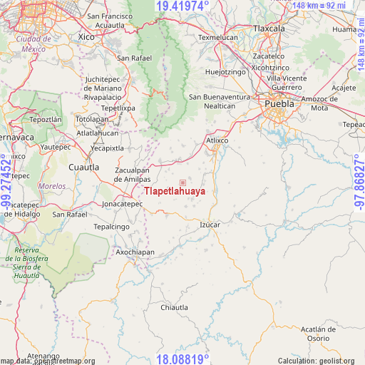
Tlapetlahuaya GPS coordinates[2]
18° 45' 19.008" North, 98° 34' 17.004" West
| Map corner | latitude | longitude |
|---|---|---|
| Upper-left | 19.41974°, | -99.27452° |
| Center: | 18.75528°, | -98.57139° |
| Lower-right: | 18.08819°, | -97.86827° |
| Map W x H: | 148.1×148.1 km | = 92×92mi |
| max Lat: | 32.7° ⇑69.4% North |
| Tlapetlahuaya: | 18.75528° |
| min Lat: | ⇓30.6% South 14.53588° |
| min Long | Tlapetlahuaya | max Long |
| -117.105° | -98.57139° | -86.73105° |
| W 56.4%⇐ | ⇒43.6% E |
Elevation
Elevation of Tlapetlahuaya is 1526 m = 5007 ft, and this is 272.3 m = 893 ft above average elevation for this country.
| Max E: |
3497 m = 11473 ft | 47.9% |
| Tlapetlahuaya | 1526 m 5007 ft | |
| Avg. | 1253.7 m = 4113 ft | |
Min E: |
-1 m = -3 ft | 52.1% |
See also: Mexico elevation on elevation.city.
Geographical zone
Tlapetlahuaya is located in North Torrid zone (between Equator and Tropic of Cancer). Distance of this Northern Tropic circle is 520.5 km =323.4 mi to North.| Distance of | km | miles | from Tlapetlahuaya |
|---|---|---|---|
| North Pole | 7921.7 | 4922.3 | to North |
| Arctic Circle | 5315.8 | 3303.1 | to North |
| Tropic Cancer | 520.5 | 323.4 | to North |
| Equator | 2085.4 | 1295.8 | to South |


Nearby cities:
15 places around Tlapetlahuaya: (largest is in red/bold)
• Colonia las Palmas
6.9 km =4.3 mi,  161°
161°
• Huaquechula
3.3 km =2.1 mi,  57°
57°
• San Diego el Organal
6.4 km =4 mi,  115°
115°
• San Felipe Tepemaxalco
6.6 km =4.1 mi,  251°
251°
• San Francisco Xochiteopan
7.8 km =4.8 mi,  314°
314°
• San Juan Vallarta
7.8 km =4.8 mi,  108°
108°
• San Miguel Aguacomulican
7.8 km =4.8 mi,  16°
16°
• San Pedro Ixhuatepec
8.2 km =5.1 mi,  303°
303°
• Santiago Atzitzihuacán
7.8 km =4.8 mi,  352°
352°
• Santiago Tetla
3.7 km =2.3 mi,  92°
92°
• Santo Domingo Ayotlicha
3.9 km =2.4 mi,  188°
188°
• Soto y Gama
9.2 km =5.7 mi, 85°
• Teacalco de Dorantes (San José Teacalco)
8.7 km =5.4 mi,  51°
51°
• Tezonteopan de Bonilla
8.5 km =5.3 mi,  95°
95°
• Tlapanalá
7.6 km =4.7 mi,  150°
150°
Sources, notices
• [Note1] Compared only with cities in Mexico existing in our database
• [Src1] Map data: © OpenStreetMap contributors (CC-BY-SA)
• [Src2] Other city data from geonames.org with taken over terms of usage.
• [Src3] Geographical zone / Annual Mean Temperature by Robert A. Rohde @ Wikipedia
