San Diego el Organal geodata
San Diego el Organal (Puebla) is a populated place; located in Mexico in America/Mexico_City (GMT-6) time zone. With population of 1,982 people, there are 4396 cities with bigger population in this country. Compared to other cities in Mexico, 69.8% of cities are located further ↑North; 57% of cities are located further ←West and 51.2% of cities have lower elevation than San Diego el Organal. Note1


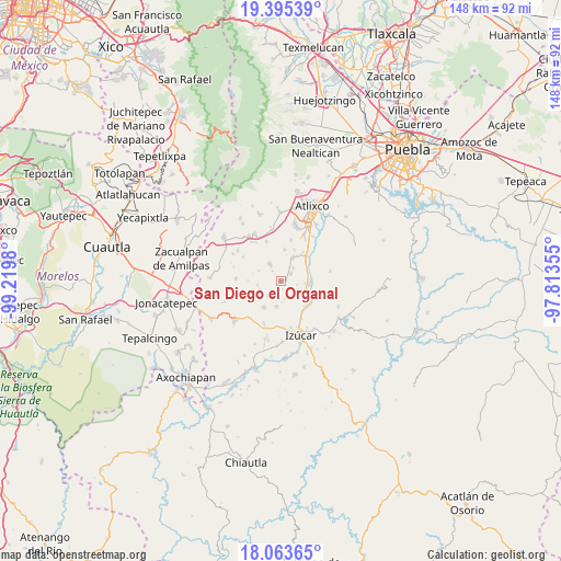
San Diego el Organal GPS coordinates[2]
18° 43' 50.988" North, 98° 31' 0.012" West
| Map corner | latitude | longitude |
|---|---|---|
| Upper-left | 19.39539°, | -99.2198° |
| Center: | 18.73083°, | -98.51667° |
| Lower-right: | 18.06365°, | -97.81355° |
| Map W x H: | 148.1×148.1 km | = 92×92mi |
| max Lat: | 32.7° ⇑69.8% North |
| San Diego el Organal: | 18.73083° |
| min Lat: | ⇓30.2% South 14.53588° |
| min Long | San Diego el Or | max Long |
| -117.105° | -98.51667° | -86.73105° |
| W 57%⇐ | ⇒43% E |
Elevation
Elevation of San Diego el Organal is 1494 m = 4902 ft, and this is 240.3 m = 788 ft above average elevation for this country.
| Max E: |
3497 m = 11473 ft | 48.8% |
| San Diego el Organal | 1494 m 4902 ft | |
| Avg. | 1253.7 m = 4113 ft | |
Min E: |
-1 m = -3 ft | 51.2% |
See also: Mexico elevation on elevation.city.
Geographical zone
San Diego el Organal is located in North Torrid zone (between Equator and Tropic of Cancer). Distance of this Northern Tropic circle is 523.2 km =325.1 mi to North.| Distance of | km | miles | from San Diego el Organal |
|---|---|---|---|
| North Pole | 7924.4 | 4924 | to North |
| Arctic Circle | 5318.5 | 3304.8 | to North |
| Tropic Cancer | 523.2 | 325.1 | to North |
| Equator | 2082.7 | 1294.1 | to South |


Nearby cities:
15 places around San Diego el Organal: (largest is in red/bold)
• Cacaloxúchitl
7.1 km =4.4 mi,  27°
27°
• Coatepec
8.4 km =5.2 mi,  212°
212°
• Colonia las Palmas
5.2 km =3.2 mi,  222°
222°
• Huaquechula
5.4 km =3.4 mi,  326°
326°
• San Juan Vallarta
1.7 km =1.1 mi,  81°
81°
• San Pedro Teyuca
7.5 km =4.7 mi,  69°
69°
• Santiago Tetla
3.3 km =2.1 mi,  320°
320°
• Santo Domingo Ayotlicha
6.4 km =4 mi,  260°
260°
• Soto y Gama
4.8 km =3 mi,  44°
44°
• Teacalco de Dorantes (San José Teacalco)
8.2 km =5.1 mi,  6°
6°
• Tepapayeca
6.9 km =4.3 mi,  191°
191°
• Tepeojuma
7.4 km =4.6 mi,  95°
95°
• Tezonteopan de Bonilla
3.3 km =2.1 mi,  54°
54°
• Tlapanalá
4.4 km =2.7 mi, 207°
• Tlapetlahuaya
6.4 km =4 mi,  295°
295°
Sources, notices
• [Note1] Compared only with cities in Mexico existing in our database
• [Src1] Map data: © OpenStreetMap contributors (CC-BY-SA)
• [Src2] Other city data from geonames.org with taken over terms of usage.
• [Src3] Geographical zone / Annual Mean Temperature by Robert A. Rohde @ Wikipedia
